Tumut Tumbarumba Suburbs & Region, Tumut Tumbarumba Map & Postcodes
Tumut Tumbarumba Suburbs & Region, Tumut Tumbarumba Map & Postcodes in Tumut Tumbarumba, Riverina, NSW, AU
Tumut Tumbarumba Region
Region Name
Tumut Tumbarumba (NSW, AU)Tumut Tumbarumba Area
9175 square kilometers (9,175 ㎢)Postal Codes
2582, 2624, from 2627 to 2629, 2649, 2653, 2720, and 2730 (In total, there are 9 postcodes in Tumut Tumbarumba.)Tumut Tumbarumba Introduction
Tumut Tumbarumba is a town in the Riverina region of New South Wales, Australia. It is situated on the banks of the Murray River and is approximately 350 kilometers west of Sydney. The town is known for its scenic surroundings, including the Tumut Mountains and the Tumut National Park. The population of Tumut Tumbarumba is around 4,000 people, and the town has a variety of amenities, including a hospital, a supermarket, a golf course, and a variety of recreational facilities. The town is also home to a number of historic buildings, including the Tumut Courthouse and the Old Tumut Post Office.Australia State
City or Big Region
District or Regional Area
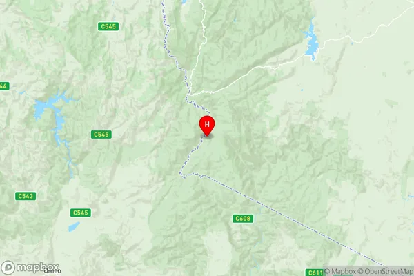
Tumut Tumbarumba Region Map
Tumut Tumbarumba Postcodes / Zip Codes
Tumut Tumbarumba Suburbs
Tumut Tumbarumba full address
Tumut Tumbarumba, Riverina, New South Wales, NSW, Australia, SaCode: 11302Country
Tumut Tumbarumba, Riverina, New South Wales, NSW, Australia, SaCode: 11302
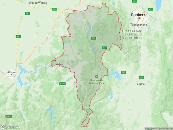
Tumut Tumbarumba Suburbs & Region, Tumut Tumbarumba Map & Postcodes has 3 areas or regions above, and there are 118 Tumut Tumbarumba suburbs below. The sa3code for the Tumut Tumbarumba region is 11302. Its latitude and longitude coordinates are -36.6781,148.208.
Tumut Tumbarumba Suburbs & Localities
1. Bowning
2. Cavan
3. Dog Trap Crossing
4. Goondah
5. Nanima
6. Woolgarlo
7. Berremangra
8. Boambolo
9. Bookham
10. Good Hope
11. Jeir
12. Kangiara
13. Nanangroe
14. Wee Jasper
15. Kosciusko
16. Creel Bay
17. East Jindabyne
18. Kalkite
19. Kosciusko
20. Kosciuszko
21. Kosciuszko National Park
22. Pilot Wilderness
23. Adaminaby
24. Broken Dam
25. Cabramurra
26. Kiandra
27. Charlottes Pass
28. Burrungubugge
29. Grosses Plain
30. Ingebirah
31. Jacobs River
32. Moonbah
33. Nungar
34. Laurel Hill
35. Munderoo
36. Taradale
37. Glenroy
38. Mannus
39. Burrinjuck
40. Jerrawa
41. Laverstock
42. Marchmont
43. Mullion
44. Narrangullen
45. Yass River
46. Bango
47. Manton
48. Murrumbateman
49. Tangmangaroo
50. Yass
51. Blue Cow
52. Charlotte Pass
53. Perisher Valley
54. Wilsons Valley
55. Gungarlin
56. Ingebyra
57. Guthega
58. Munyang
59. Smiggin Holes
60. Bullocks Flat
61. Crackenback
62. Kosciusko National Park
63. Ingeegoodbee
64. Jindabyne
65. Ngarigo
66. Hill Top
67. Anglers Reach
68. Gooandra
69. Old Adaminaby
70. Tantangara
71. Nurenmerenmong
72. Lower Thredbo
73. Sawpit Creek
74. Providence Portal
75. Tolbar
76. Yaouk
77. Burra
78. Courabyra
79. Maragle
80. Paddys River
81. Westdale
82. Willigobung
83. Tumbarumba
84. Argalong
85. Bombowlee
86. Courajago
87. Gilmore
88. Lacmalac
89. Little River
90. Midway
91. Talbingo
92. Tumut
93. Tumut Plains
94. Wereboldera
95. Wyangle
96. Batlow
97. Lower Bago
98. Bogong Peaks Wilderness
99. Buddong
100. Goobarragandra
101. Killimicat
102. Minjary
103. Mundongo
104. Wermatong
105. Bago
106. Kunama
107. Blowering
108. Bombowlee Creek
109. Couragago
110. Gadara
111. Gocup
112. Red Hill
113. Windowie
114. Green Hills
115. Jones Bridge
116. Pinbeyan
117. Tumorrama
118. Yarrangobilly