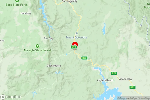
Cooma Region Suburbs & Region, Cooma Region Map & Postcodes
Cooma Region Suburbs & Region, Cooma Region Map & Postcodes in Cooma Region, Tumut Tumbarumba, Riverina, NSW, AU
Cooma Region Region
Region Name
Cooma Region (NSW, AU)Cooma Region Area
6251 square kilometers (6,251 ㎢)Postal Codes
2626, 2627, and from 2629 to 2631 (In total, there are 5 postcodes in Cooma Region.)Cooma Region Introduction
Cooma Region is a region located in the Riverina district of New South Wales, Australia. It is situated in the south-west of the state, bordering the ACT and Victoria. The region is known for its scenic landscapes, including the Snowy Mountains and the Monaro Plain. It is home to the town of Cooma, which is the administrative center of the region. The region is a major producer of wheat, cotton, and sheep. It is also home to a number of national parks and reserves, including the Kosciuszko National Park and the Namadgi National Park.Australia State
City or Big Region
Greater Capital City
Rest of NSW (1RNSW)District or Regional Area
Suburb Name
Cooma Region Region Map

Cooma Region Postcodes / Zip Codes
Cooma Region Suburbs
Cooma Region full address
Cooma Region, Tumut Tumbarumba, Riverina, New South Wales, NSW, Australia, SaCode: 101031015Country
Cooma Region, Tumut Tumbarumba, Riverina, New South Wales, NSW, Australia, SaCode: 101031015
Cooma Region Suburbs & Region, Cooma Region Map & Postcodes has 0 areas or regions above, and there are 55 Cooma Region suburbs below. The sa2code for the Cooma Region region is 101031015. Its latitude and longitude coordinates are -35.8666,148.497. Cooma Region area belongs to Australia's greater capital city Rest of NSW.
Cooma Region Suburbs & Localities
1. Bredbo
2. Bumbalong
3. Colinton
4. Kosciusko National Park
5. Kosciuszko National Park
6. Adaminaby
7. Anglers Reach
8. Bolaro
9. Broken Dam
10. Gooandra
11. Kiandra
12. Nungar
13. Old Adaminaby
14. Providence Portal
15. Tantangara
16. Tolbar
17. Yaouk
18. Arable
19. Badja
20. Billilingra
21. Binjura
22. Bobundara
23. Bunyan
24. Carlaminda
25. Chakola
26. Coolringdon
27. Coonerang
28. Countegany
29. Dairymans Plains
30. Dangelong
31. Dry Plain
32. Frying Pan
33. Glen Fergus
34. Jerangle
35. Maffra
36. Middle Flat
37. Murrumbucca
38. Myalla
39. Numeralla
40. Peak View
41. Rhine Falls
42. Rock Flat
43. Rose Valley
44. Shannons Flat
45. Springfield
46. The Brothers
47. Tuross
48. Wambrook
49. Bocci
50. Greenlands
51. Jimcumbilly
52. Kybeyan
53. Nimmitabel
54. Steeple Flat
55. Winifred
