Mayfield Warabrook Suburbs & Region, Mayfield Warabrook Map & Postcodes
Mayfield Warabrook Suburbs & Region, Mayfield Warabrook Map & Postcodes in Mayfield Warabrook, Shoalhaven, Southern Highlands and Shoalhaven, NSW, AU
Mayfield Warabrook Region
Region Name
Mayfield Warabrook (NSW, AU)Mayfield Warabrook Area
7.54 square kilometers (7.54 ㎢)Postal Codes
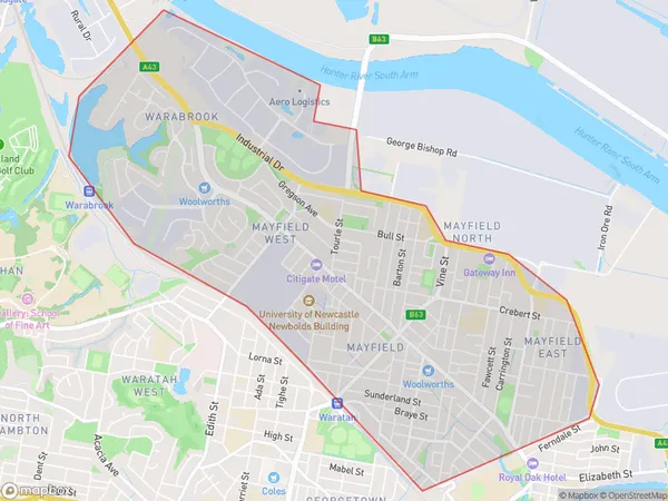
2304 (In total, there are 1 postcodes in Mayfield Warabrook.)Mayfield Warabrook Suburb Area Map (Polygon)
Mayfield Warabrook Introduction
Mayfield Warabrook is a suburb of the City of Shoalhaven in New South Wales, Australia. It is located in the Southern Highlands and Shoalhaven regions and is about 31 kilometers south of Nowra. The post office opened on 1 October 1908 and was closed on 1 February 1984. The suburb is named after the Warabrook River, which flows through it. The population of Mayfield Warabrook at the 2011 census was 1,345.Australia State
City or Big Region
Greater Capital City
Rest of NSW (1RNSW)District or Regional Area
Suburb Name
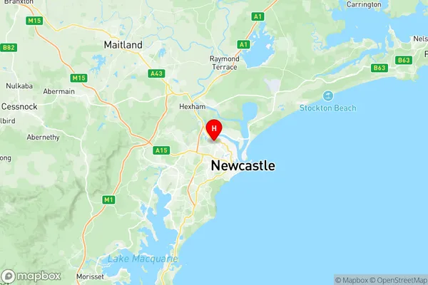
Mayfield Warabrook Region Map
Mayfield Warabrook Postcodes / Zip Codes
Mayfield Warabrook Suburbs
Mayfield Warabrook full address
Mayfield Warabrook, Shoalhaven, Southern Highlands and Shoalhaven, New South Wales, NSW, Australia, SaCode: 111031227Country
Mayfield Warabrook, Shoalhaven, Southern Highlands and Shoalhaven, New South Wales, NSW, Australia, SaCode: 111031227
Mayfield Warabrook Suburbs & Region, Mayfield Warabrook Map & Postcodes has 0 areas or regions above, and there are 5 Mayfield Warabrook suburbs below. The sa2code for the Mayfield Warabrook region is 111031227. Its latitude and longitude coordinates are -32.89,151.726. Mayfield Warabrook area belongs to Australia's greater capital city Rest of NSW.
Mayfield Warabrook Suburbs & Localities
1. Mayfield
2. Mayfield
3. Mayfield East
4. Mayfield West
5. Warabrook