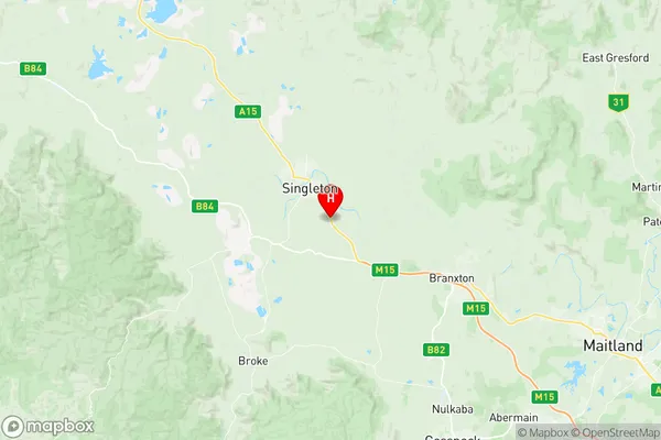
Singleton Suburbs & Region, Singleton Map & Postcodes
Singleton Suburbs & Region, Singleton Map & Postcodes in Singleton, Lower Hunter, Hunter Valley exc Newcastle, NSW, AU
Singleton Region
Region Name
Singleton (NSW, AU)Singleton Area
127.23 square kilometers (127.23 ㎢)Postal Codes
2330, and 2331 (In total, there are 2 postcodes in Singleton.)Singleton Introduction
Singleton is a city in the Hunter Region of New South Wales, Australia, 65 kilometers (40 mi) south of Newcastle, and 125 kilometers (78 mi) north of Sydney. It is the administrative center of the Singleton Council and the Singleton Shire. The town is situated in the Hunter Valley, a wine-growing region, and is known for its coal mines, power stations, and agricultural industries. Singleton has a population of around 20,000 people and is home to several historic sites, including Singleton Castle and the Singleton Museum.Australia State
City or Big Region
Greater Capital City
Rest of NSW (1RNSW)District or Regional Area
Suburb Name
Singleton Region Map

Singleton Postcodes / Zip Codes
Singleton Suburbs
Singleton full address
Singleton, Lower Hunter, Hunter Valley exc Newcastle, New South Wales, NSW, Australia, SaCode: 106011112Country
Singleton, Lower Hunter, Hunter Valley exc Newcastle, New South Wales, NSW, Australia, SaCode: 106011112
Singleton Suburbs & Region, Singleton Map & Postcodes has 0 areas or regions above, and there are 19 Singleton suburbs below. The sa2code for the Singleton region is 106011112. Its latitude and longitude coordinates are -32.5997,151.199. Singleton area belongs to Australia's greater capital city Rest of NSW.
Singleton Suburbs & Localities
1. Combo
2. Darlington
3. Dunolly
4. Fern Gully
5. Glenridding
6. Gowrie
7. Hambledon Hill
8. Hunterview
9. Mcdougalls Hill
10. Obanvale
11. Redbournberry
12. Rixs Creek
13. Singleton
14. Singleton Dc
15. Singleton Heights
16. Wattle Ponds
17. Whittingham
18. Wylies Flat
19. Singleton Milpo
