Far West Suburbs & Region, Far West Map & Postcodes
Far West Suburbs & Region, Far West Map & Postcodes in Far West, Broken Hill and Far West, Far West and Orana, NSW, AU
Far West Region
Region Name
Far West (NSW, AU)Far West Area
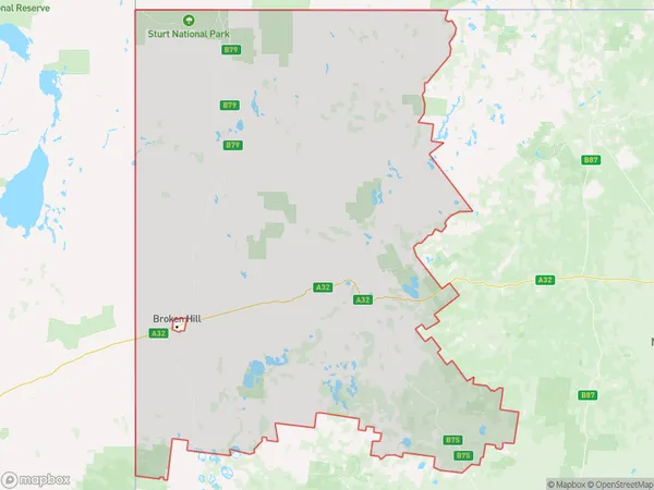
146685 square kilometers (146,685 ㎢)Far West Suburb Area Map (Polygon)
Far West Introduction
Far West, Far West and Orana is a locality in the City of Blue Mountains, New South Wales, Australia. It is located 55 kilometers west of Sydney and is part of the Greater Western Sydney region. The area is known for its scenic beauty, with the Blue Mountains to the west and the Hawkesbury River to the north. It is home to a number of historic sites, including the Old Government House and the Far West Heritage Centre. The population of the locality was 1,482 at the 2016 census.Australia State
City or Big Region
Greater Capital City
Rest of NSW (1RNSW)District or Regional Area
Suburb Name
Far West Region Map
Far West Suburbs
Far West full address
Far West, Broken Hill and Far West, Far West and Orana, New South Wales, NSW, Australia, SaCode: 105021098Country
Far West, Broken Hill and Far West, Far West and Orana, New South Wales, NSW, Australia, SaCode: 105021098
Far West Suburbs & Region, Far West Map & Postcodes has 0 areas or regions above, and there are 0 Far West suburbs below. The sa2code for the Far West region is 105021098. Its latitude and longitude coordinates are -32.3985,142.414. Far West area belongs to Australia's greater capital city Rest of NSW.