Googong Suburbs & Region, Googong Map & Postcodes
Googong Suburbs & Region, Googong Map & Postcodes in Googong, Queanbeyan, Capital Region, NSW, AU
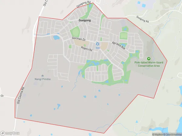
Googong Region
Region Name
Googong (NSW, AU)Googong Area
6.92 square kilometers (6.92 ㎢)Googong Suburb Area Map (Polygon)
Googong Introduction
Googong is a small town in the Central Tablelands of New South Wales, Australia. It is located in the Queanbeyan-Palerang Regional Council area and is situated on the banks of the Googong River. The town has a population of around 1,000 people and is known for its picturesque scenery, including the Googong Dam and the surrounding mountains. The town is a popular destination for outdoor activities such as hiking, camping, and fishing, and is also home to the Googong Wetlands, which are a significant area of wetlands and wildlife. The town has a general store, a post office, a pub, and a community hall, and is surrounded by farmland and forests.Australia State
City or Big Region
Greater Capital City
Rest of NSW (1RNSW)District or Regional Area
Suburb Name
Googong Suburbs
Googong full address
Googong, Queanbeyan, Capital Region, New South Wales, NSW, Australia, SaCode: 101021610Country
Googong, Queanbeyan, Capital Region, New South Wales, NSW, Australia, SaCode: 101021610
Googong Suburbs & Region, Googong Map & Postcodes has 0 areas or regions above, and there are 0 Googong suburbs below. The sa2code for the Googong region is 101021610. Googong area belongs to Australia's greater capital city Rest of NSW.