Brendale Dc Area, Brendale Dc Postcode(4500) & Map in Brendale Dc, Moreton Bay - South, QLD
Brendale Dc Area, Brendale Dc Postcode(4500) & Map in Brendale Dc, Moreton Bay - South, QLD, AU, Postcode: 4500
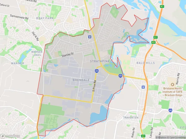
Brendale Dc, Strathpine - Brendale, Strathpine, Moreton Bay - South, Queensland, Australia, 4500
Brendale Dc Postcode
Area Name
Brendale DcBrendale Dc Suburb Area Map (Polygon)
Brendale Dc Introduction
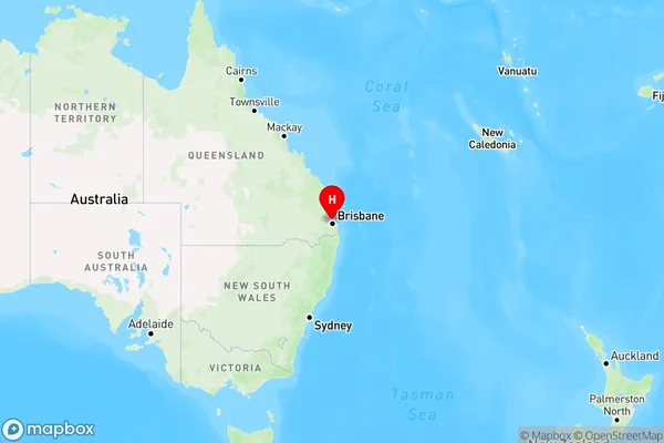
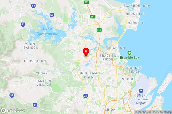
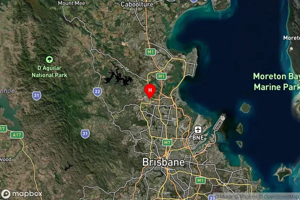
Brendale DC is a suburb of Moreton Bay, South, QLD, AU, located 23 km north of Brisbane. It is known for its industrial and commercial areas, including the Brendale Industrial Estate and the Brendale Business Park. The suburb has a population of approximately 5,000 people and is home to a variety of businesses, including manufacturing, logistics, and transportation.State Name
City or Big Region
District or Regional Area
Suburb Name
Brendale Dc Region Map
Country
Main Region in AU
R2Coordinates
-27.3177,152.987 (latitude/longitude)Brendale Dc Area Map (Street)
Longitude
152.939438Latitude
-27.307845Brendale Dc Suburb Map (Satellite)
Distances
The distance from Brendale Dc, Moreton Bay - South, QLD to AU Greater Capital CitiesSA1 Code 2011
31403139421SA1 Code 2016
31403139421SA2 Code
314031394SA3 Code
31403SA4 Code
314RA 2011
1RA 2016
1MMM 2015
1MMM 2019
1Charge Zone
Q1LGA Region
BrisbaneLGA Code
31000Electorate
Dickson