Brisbane Exhibition Area, Brisbane Exhibition Postcode(4006) & Map in Brisbane Exhibition, Brisbane Inner City, QLD
Brisbane Exhibition Area, Brisbane Exhibition Postcode(4006) & Map in Brisbane Exhibition, Brisbane Inner City, QLD, AU, Postcode: 4006
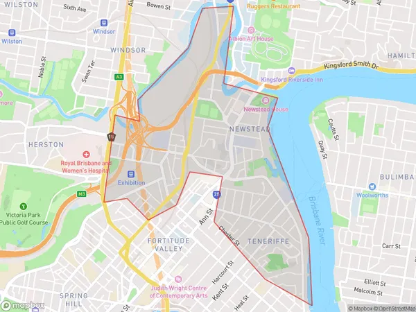
Brisbane Exhibition, Newstead - Bowen Hills, Brisbane Inner - North, Brisbane Inner City, Queensland, Australia, 4006
Brisbane Exhibition Postcode
Area Name
Brisbane ExhibitionBrisbane Exhibition Suburb Area Map (Polygon)
Brisbane Exhibition Introduction
The Brisbane Exhibition is a heritage-listed site located in the Brisbane Inner City, Queensland, Australia. It was designed by John H. Buckeridge and built in 1886-1887. The building is rectangular in plan and is constructed of timber and brick with a hipped roof. It features a central pavilion with a domed roof and a verandah along the eastern and western sides. The exhibition grounds were used for a variety of events, including exhibitions, shows, and fairs, until the early 1990s. Today, the building is used for a range of purposes, including offices, retail spaces, and event venues.State Name
City or Big Region
District or Regional Area
Suburb Name
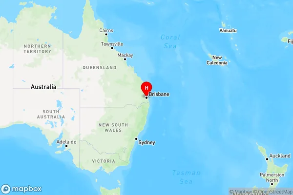
Brisbane Exhibition Region Map
Country
Main Region in AU
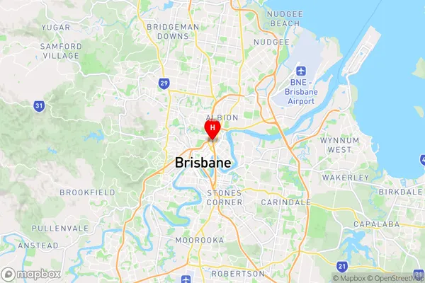
R1Coordinates
-27.4508,153.033 (latitude/longitude)Brisbane Exhibition Area Map (Street)
Longitude
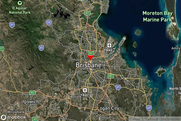
153.175242Latitude
-27.36618Brisbane Exhibition Suburb Map (Satellite)
Distances
The distance from Brisbane Exhibition, Brisbane Inner City, QLD to AU Greater Capital CitiesSA1 Code 2011
30503112805SA1 Code 2016
30503112805SA2 Code
305031128SA3 Code
30503SA4 Code
305RA 2011
1RA 2016
1MMM 2015
1MMM 2019
1Charge Zone
Q1LGA Region
BrisbaneLGA Code
31000Electorate
Brisbane