Chullora Area, Chullora Postcode(2190) & Map in Chullora, Sydney - Inner South West, NSW
Chullora Area, Chullora Postcode(2190) & Map in Chullora, Sydney - Inner South West, NSW, AU, Postcode: 2190
Chullora, Chullora, Bankstown, Sydney - Inner South West, New South Wales, Australia, 2190
Chullora Postcode
Area Name
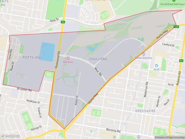
ChulloraChullora Suburb Area Map (Polygon)
Chullora Introduction
Chullora is a suburb in the Inner South West of Sydney, in New South Wales, Australia. It is located 16 kilometers south-west of the Sydney central business district and is part of the City of Canada Bay. Chullora is known for its large industrial area and has a population of around 11,000 people. The suburb has a number of parks and recreational facilities, including a sports complex and a community center.State Name
City or Big Region
District or Regional Area
Suburb Name
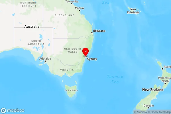
Chullora Region Map
Country
Main Region in AU
R1Coordinates
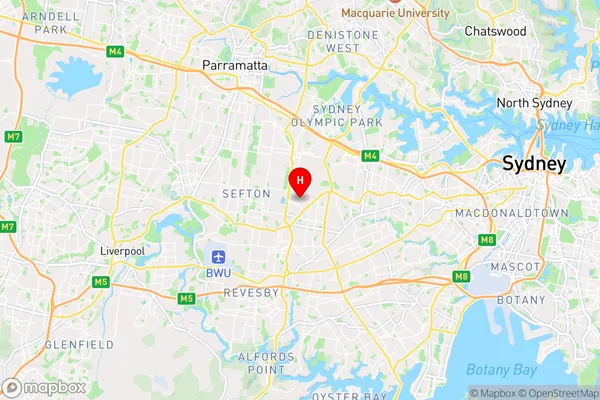
-33.8908,151.0475 (latitude/longitude)Chullora Area Map (Street)
Longitude
151.053858Latitude
-33.901925Chullora Elevation
about 39.59 meters height above sea level (Altitude)Chullora Suburb Map (Satellite)

Distances
The distance from Chullora, Sydney - Inner South West, NSW to AU Greater Capital CitiesSA1 Code 2011
11901135501SA1 Code 2016
11901135501SA2 Code
119011355SA3 Code
11901SA4 Code
119RA 2011
1RA 2016
1MMM 2015
1MMM 2019
1Charge Zone
N1LGA Region
Canterbury-BankstownLGA Code
11570Electorate
Watson