Figtree Area, Figtree Postcode(2525) & Map in Figtree, Illawarra, NSW
Figtree Area, Figtree Postcode(2525) & Map in Figtree, Illawarra, NSW, AU, Postcode: 2525
Figtree, Figtree - Keiraville, Wollongong, Illawarra, New South Wales, Australia, 2525
Figtree Postcode
Area Name
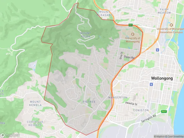
FigtreeFigtree Suburb Area Map (Polygon)
Figtree Introduction
The Figtree is a suburb in the Illawarra region of New South Wales, Australia. It is located 36 kilometers south of Wollongong and 86 kilometers south of Sydney. The suburb is named after the fig trees that line the streets. Figtree is a popular residential area with a variety of housing options, including apartments, units, and houses. It has a number of parks and recreational facilities, including a swimming pool, tennis courts, and a golf course. The suburb is also home to a number of businesses, including a shopping center and a hospital.State Name
City or Big Region
District or Regional Area
Suburb Name
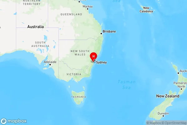
Figtree Region Map
Country
Main Region in AU
R2Coordinates
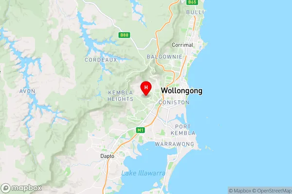
-34.4319396,150.8434913 (latitude/longitude)Figtree Area Map (Street)
Longitude
150.818904Latitude
-34.437229Figtree Elevation
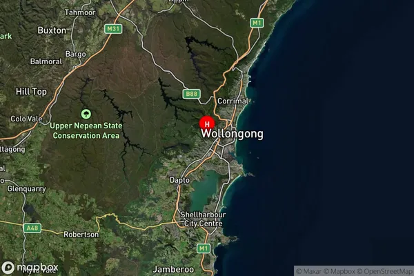
about 144.05 meters height above sea level (Altitude)Figtree Suburb Map (Satellite)
Distances
The distance from Figtree, Illawarra, NSW to AU Greater Capital CitiesSA1 Code 2011
10704114610SA1 Code 2016
10704114610SA2 Code
107041146SA3 Code
10704SA4 Code
107RA 2011
1RA 2016
1MMM 2015
1MMM 2019
1Charge Zone
N1LGA Region
WollongongLGA Code
18450Electorate
Cunningham