Perth Airport Area, Perth Airport Postcode(6105) & Map in Perth Airport, Perth - South East, WA
Perth Airport Area, Perth Airport Postcode(6105) & Map in Perth Airport, Perth - South East, WA, AU, Postcode: 6105
Perth Airport, Perth Airport, Belmont - Victoria Park, Perth - South East, Western Australia, Australia, 6105
Perth Airport Postcode
Area Name
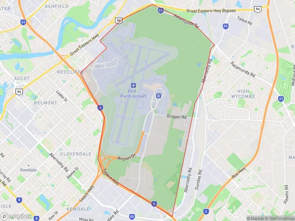
Perth AirportPerth Airport Suburb Area Map (Polygon)
Perth Airport Introduction
Perth Airport is the primary airport serving Perth, Western Australia, and is located approximately 18 kilometers east of the city center. It is the fourth busiest airport in Australia and offers flights to domestic and international destinations. The airport features two terminals, a range of shopping and dining options, and a variety of transportation options, including buses, taxis, and rental cars.State Name
City or Big Region
District or Regional Area
Suburb Name
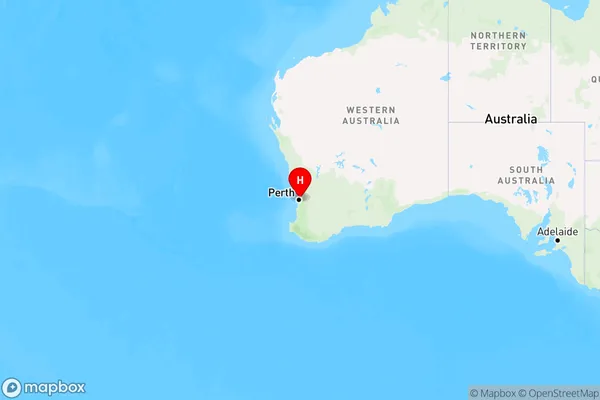
Perth Airport Region Map
Country
Main Region in AU
R2Coordinates
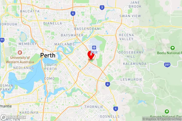
-31.9657302,115.9586253 (latitude/longitude)Perth Airport Area Map (Street)
Longitude
115.963293Latitude
-31.95388Perth Airport Elevation
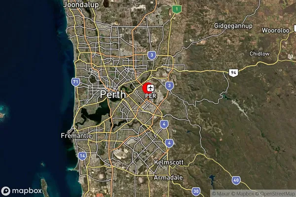
about 19.85 meters height above sea level (Altitude)Perth Airport Suburb Map (Satellite)
Distances
The distance from Perth Airport, Perth - South East, WA to AU Greater Capital CitiesSA1 Code 2011
50602112101SA1 Code 2016
50602112102SA2 Code
506021121SA3 Code
50602SA4 Code
506RA 2011
1RA 2016
1MMM 2015
1MMM 2019
1Charge Zone
W1LGA Region
BelmontLGA Code
50490Electorate
Swan