Wivenhoe Area, Wivenhoe Postcode(7320) & Map in Wivenhoe, West and North West, TAS
Wivenhoe Area, Wivenhoe Postcode(7320) & Map in Wivenhoe, West and North West, TAS, AU, Postcode: 7320
Wivenhoe, Burnie - Wivenhoe, Burnie - Ulverstone, West and North West, Tasmania, Australia, 7320
Wivenhoe Postcode
Area Name
WivenhoeWivenhoe Suburb Area Map (Polygon)
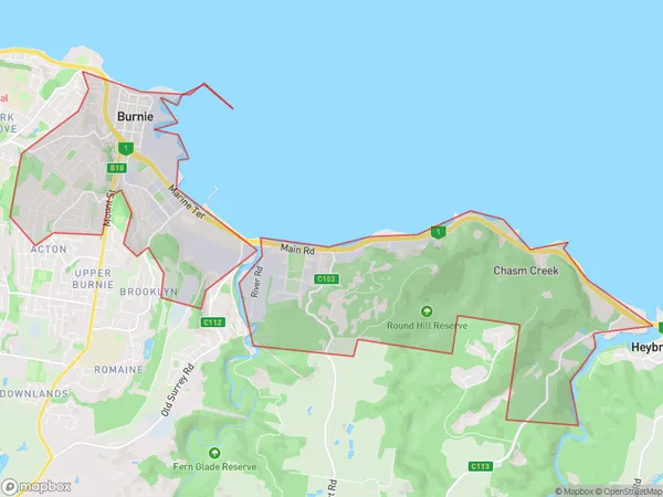
Wivenhoe Introduction
Wivenhoe, West and North West are three suburbs in Tasmania, Australia. They are located on the banks of the Tamar River and are known for their scenic beauty, including the Cataract Gorge and the Tamar Valley Wine Region. The area is also home to several schools, including Wivenhoe Primary School and Launceston College.State Name
City or Big Region
District or Regional Area
Suburb Name
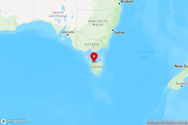
Wivenhoe Region Map
Country
Main Region in AU
R3Coordinates
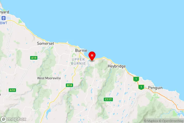
-41.0709777,145.9308332 (latitude/longitude)Wivenhoe Area Map (Street)
Longitude
145.862079Latitude
-41.08422Wivenhoe Elevation
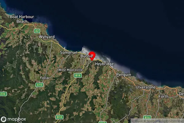
about 171.80 meters height above sea level (Altitude)Wivenhoe Suburb Map (Satellite)
Distances
The distance from Wivenhoe, West and North West, TAS to AU Greater Capital CitiesSA1 Code 2011
60401107709SA1 Code 2016
60401107709SA2 Code
604011077SA3 Code
60401SA4 Code
604RA 2011
3RA 2016
3MMM 2015
3MMM 2019
3Charge Zone
T1LGA Region
BurnieLGA Code
60610Electorate
Braddon