Stoneburn Suburbs & Region, Stoneburn Map & Postcodes in Stoneburn, Palmerston, Otago
Stoneburn Postcodes, Stoneburn ZipCodes, Stoneburn , Stoneburn Otago, Stoneburn Suburbs, Stoneburn Region, Stoneburn Map, Stoneburn Area
Stoneburn Region
Stoneburn Suburbs
Stoneburn is a suburb place type in Palmerston, Otago, NZ. It contains 0 suburbs or localities.Stoneburn Postcodes
Stoneburn district
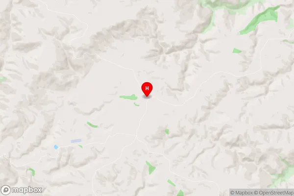
WaitakiStoneburn Region Map
Stoneburn Introduction
Stoneburn is a small rural community located in the Otago region of New Zealand, approximately 20 kilometers south of Dunedin. It is known for its picturesque stone buildings, including the Stoneburn Hotel, which was built in 1877 and is a popular tourist destination. The community has a population of around 300 people and is surrounded by farmland and scenic countryside. Stoneburn is also home to a variety of wildlife, including kea, tui, and stoats. The area has a rich history, with several historic buildings and sites, including the Stoneburn Quarry, which was used to extract stone for construction in the area.Stoneburn Region
Stoneburn City
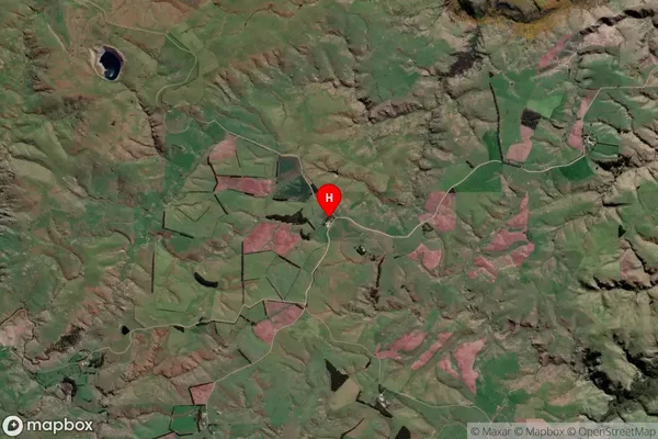
Stoneburn Satellite Map
Full Address
Stoneburn, Palmerston, OtagoStoneburn Coordinates
-45.42972,170.564654 (Latitude / Longitude)Stoneburn Map in NZ
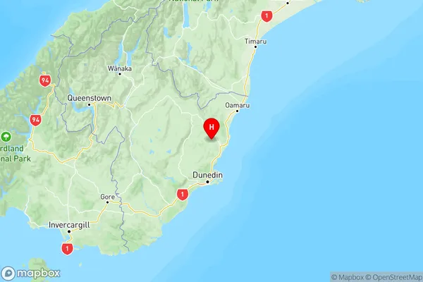
NZ Island
South IslandCountry
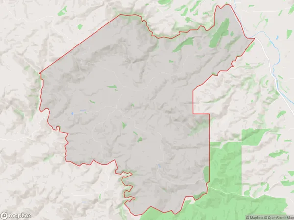
Stoneburn Area Map (Polygon)
Name
StoneburnAdditional Name
Local Authority
Waitaki District
Stoneburn Suburbs (Sort by Population)
Stoneburn suburb has around
77.7 square
kilometers.There are more than 20 people (estimated)
live in Stoneburn, Palmerston, Otago, New Zealand.