Waingaro Suburbs & Region, Waingaro Map & Postcodes in Waingaro, Ngaruawahia, Waikato
Waingaro Postcodes, Waingaro ZipCodes, Waingaro , Waingaro Waikato, Waingaro Suburbs, Waingaro Region, Waingaro Map, Waingaro Area
Waingaro Region (Dunmore, Ohautira Region)
Waingaro Suburbs
Waingaro is a suburb place type in Ngaruawahia, Waikato, NZ. It contains 0 suburbs or localities.Waingaro Postcodes
Waingaro district
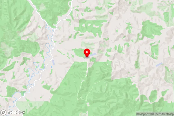
WaikatoWaingaro Region Map
Waingaro Introduction
Waingaro is a small town in the Waikato region of New Zealand. It is located on the banks of the Waikato River, approximately 35 kilometers south of Hamilton. The town has a population of around 3,000 people and is known for its scenic surroundings, including the Waingaro Waterfalls and the Waingaro Forest Park. Waingaro is also home to a number of historic buildings, including the Waingaro Hotel and the Waingaro School of Mines. The town is a popular destination for outdoor activities such as hiking, cycling, and fishing, and is also close to a number of popular tourist attractions, including the Hobbiton Movie Set and the Waitomo Caves.Waingaro Region
Waingaro City
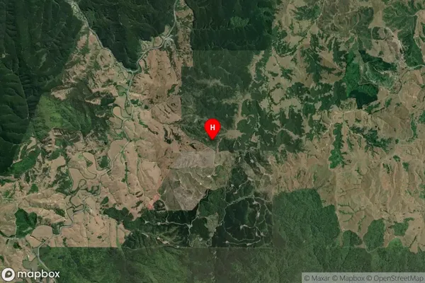
Waingaro Satellite Map
Full Address
Waingaro, Ngaruawahia, WaikatoWaingaro Coordinates
-37.711182,175.01103 (Latitude / Longitude)Waingaro Map in NZ
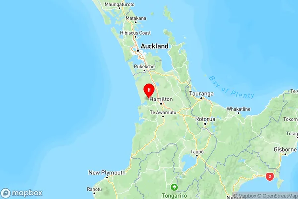
NZ Island
North IslandCountry
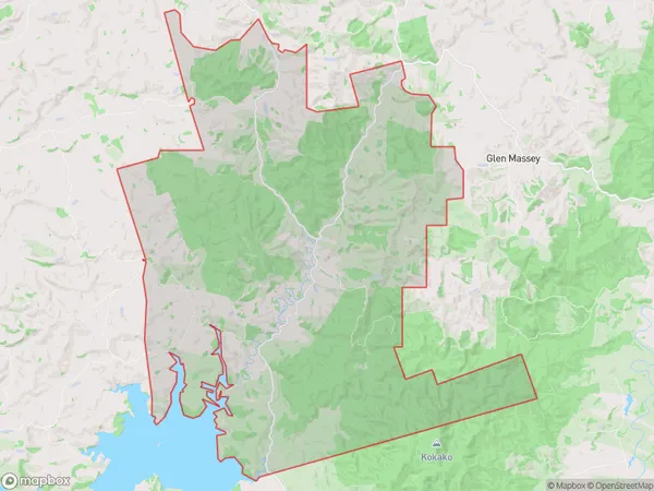
Waingaro Area Map (Polygon)
Name
WaingaroAdditional Name
Dunmore, OhautiraLocal Authority
Waikato District
Waingaro Suburbs (Sort by Population)
Waingaro also known as Dunmore, Ohautira. Waingaro suburb has around
158.3 square
kilometers.There are more than 309 people (estimated)
live in Waingaro, Ngaruawahia, Waikato, New Zealand.