Hadlow Suburbs & Region, Hadlow Map & Postcodes in Hadlow, Timaru, Canterbury
Hadlow Postcodes, Hadlow ZipCodes, Hadlow , Hadlow Canterbury, Hadlow Suburbs, Hadlow Region, Hadlow Map, Hadlow Area
Hadlow Region (Rosewill Valley Region)
Hadlow Suburbs
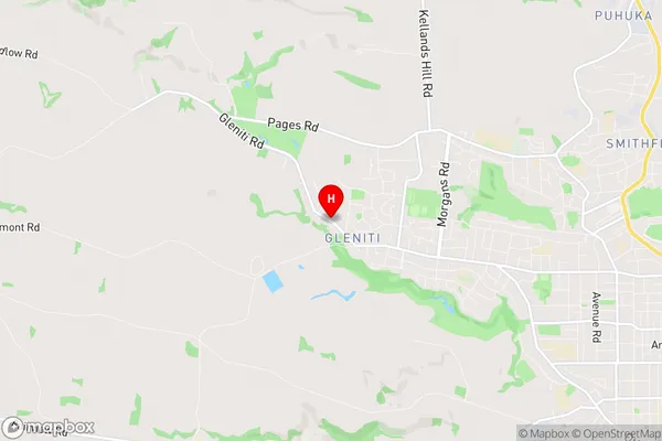
Hadlow is a suburb place type in Timaru, Canterbury, NZ. It contains 0 suburbs or localities.Hadlow Region Map
Hadlow Introduction
Hadlow is a small town in Canterbury, New Zealand, located on the banks of the Hurunui River. It is known for its picturesque rural setting, historic buildings, and vibrant community. The town has a population of around 1,200 people and is home to a variety of businesses, including a supermarket, a hotel, and a primary school. Hadlow is also a popular destination for outdoor enthusiasts, with nearby trails for hiking, cycling, and fishing. The town is surrounded by stunning countryside, including the Southern Alps and the Rakaia Gorge, and is only a short drive from Christchurch.Hadlow Region
Hadlow City
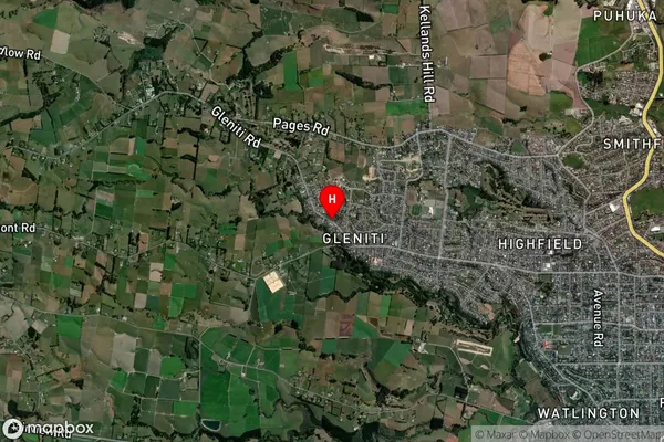
Hadlow Satellite Map
Full Address
Hadlow, Timaru, CanterburyHadlow Coordinates
-44.384696,171.19284 (Latitude / Longitude)Hadlow Map in NZ
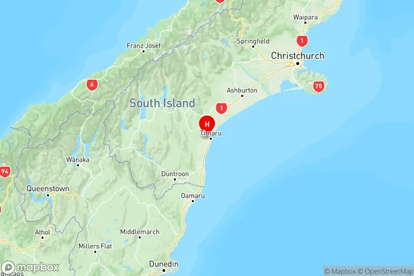
NZ Island
South IslandCountry
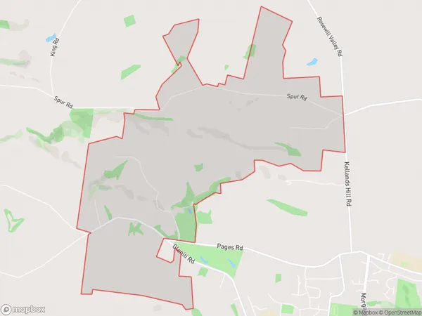
Hadlow Area Map (Polygon)
Name
HadlowAdditional Name
Rosewill ValleyLocal Authority
Timaru District
Hadlow Suburbs (Sort by Population)
Hadlow also known as Rosewill Valley. Hadlow suburb has around
8.6 square
kilometers.There are more than 234 people (estimated)
live in Hadlow, Timaru, Canterbury, New Zealand.