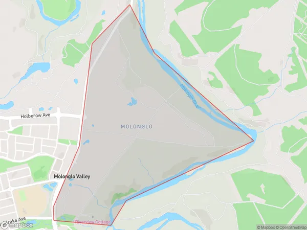
Molonglo Suburbs & Region, Molonglo Map & Postcodes
Molonglo Suburbs & Region, Molonglo Map & Postcodes in Molonglo, Australian Capital Territory, ACT, AU
Molonglo Region
Region Name
Molonglo (ACT, AU)Molonglo Area
2.19 square kilometers (2.19 ㎢)Molonglo Introduction
Molonglo is a suburb in the Australian Capital Territory (ACT) in Australia. It is located in the Molonglo Valley and is part of the Canberra Central Business District. The suburb is named after the Molonglo River, which flows through it. Molonglo is home to a number of government institutions, including the Australian Parliament House, the High Court of Australia, and the Australian National University. The suburb is also home to a number of embassies and high commissions. Molonglo is a popular residential area, with a number of large houses and apartments. The suburb has a number of parks and recreational facilities, including the Molonglo Riverwalk, which follows the course of the Molonglo River.Australia State
City or Big Region
Greater Capital City
Australian Capital Territory (8ACTE)District or Regional Area
Suburb Name
Molonglo Suburbs
Molonglo full address
Molonglo, Australian Capital Territory, ACT, Australia, SaCode: 801101137Country
Molonglo, Australian Capital Territory, ACT, Australia, SaCode: 801101137
Molonglo Suburbs & Region, Molonglo Map & Postcodes has 0 areas or regions above, and there are 0 Molonglo suburbs below. The sa2code for the Molonglo region is 801101137. Molonglo area belongs to Australia's greater capital city Australian Capital Territory.
