Wagaman Suburbs & Region, Wagaman Map & Postcodes
Wagaman Suburbs & Region, Wagaman Map & Postcodes in Wagaman, Darwin Suburbs, Darwin, NT, AU
Wagaman Region
Region Name
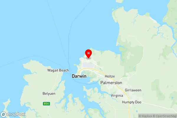
Wagaman (NT, AU)Wagaman Area
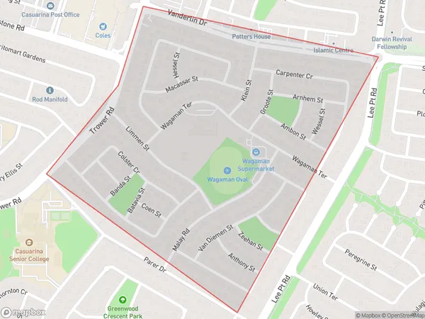
0.84 square kilometers (0.84 ㎢)Wagaman Suburb Area Map (Polygon)
Wagaman Introduction
Wagaman is a locality in the Northern Territory of Australia. It is located about 135 kilometers northeast of Darwin in the Barkly Tablelands region. Wagaman is a cattle station and has a airstrip that is used for cattle mustering and other agricultural purposes. The station is owned by the Pastoral Leaseholds Limited and has a workforce of around 20 people. The surrounding area is known for its rich agricultural land and is home to a variety of wildlife, including kangaroos, wallabies, and emus. Wagaman is a remote and isolated location, but it has a rich history and culture that is worth exploring.Australia State
City or Big Region
Greater Capital City
Greater Darwin (7GDAR)District or Regional Area
Suburb Name
Wagaman Region Map
Wagaman Suburbs
Wagaman full address
Wagaman, Darwin Suburbs, Darwin, Northern Territory, NT, Australia, SaCode: 701021028Country
Wagaman, Darwin Suburbs, Darwin, Northern Territory, NT, Australia, SaCode: 701021028
Wagaman Suburbs & Region, Wagaman Map & Postcodes has 0 areas or regions above, and there are 0 Wagaman suburbs below. The sa2code for the Wagaman region is 701021028. Its latitude and longitude coordinates are -12.3825,130.885. Wagaman area belongs to Australia's greater capital city Greater Darwin.