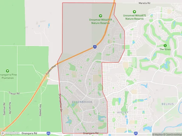
Ellenbrook Suburbs & Region, Ellenbrook Map & Postcodes
Ellenbrook Suburbs & Region, Ellenbrook Map & Postcodes in Ellenbrook, Swan, Perth North East, WA, AU
Ellenbrook Region
Region Name
Ellenbrook (WA, AU)Ellenbrook Area
13.98 square kilometers (13.98 ㎢)Ellenbrook Introduction
Ellenbrook is a suburb of Perth, the capital city of Western Australia, and is located in the City of Swan. It is named after Ellen Brook, a pioneer settler who arrived in the area in 1832. Ellenbrook is a planned suburb that was developed in the 1990s and is known for its modern homes, shopping centers, and recreational facilities. It is located approximately 15 kilometers northeast of Perth's central business district and is part of the City of Swan's growth corridor. The suburb has a population of over 20,000 people and is home to a variety of cultural and religious communities. It is also well-connected to other parts of Perth via the Perth-Mandurah railway line and the Great Eastern Highway.Australia State
City or Big Region
Greater Capital City
Greater Perth (5GPER)District or Regional Area
Suburb Name
Ellenbrook Suburbs
Ellenbrook full address
Ellenbrook, Swan, Perth North East, Western Australia, WA, Australia, SaCode: 504031300Country
Ellenbrook, Swan, Perth North East, Western Australia, WA, Australia, SaCode: 504031300
Ellenbrook Suburbs & Region, Ellenbrook Map & Postcodes has 0 areas or regions above, and there are 0 Ellenbrook suburbs below. The sa2code for the Ellenbrook region is 504031300. Ellenbrook area belongs to Australia's greater capital city Greater Perth.
