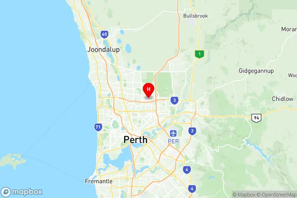
Malaga Suburbs & Region, Malaga Map & Postcodes
Malaga Suburbs & Region, Malaga Map & Postcodes in Malaga, Swan, Perth North East, WA, AU
Malaga Region
Region Name
Malaga (WA, AU)Malaga Area
6.4 square kilometers (6.4 ㎢)Postal Codes
6090, 6944, and 6945 (In total, there are 3 postcodes in Malaga.)Malaga Introduction
Malaga is a suburb located in the City of Perth, Western Australia, and is part of the Perth North East region. It is situated approximately 16 kilometers northeast of Perth's central business district (CBD) and is bordered by the suburbs of Wembley, Mount Lawley, and Dianella. Malaga is a well-established suburb with a rich history. It was originally developed as a residential area in the early 20th century and has since grown into a vibrant community with a mix of residential, commercial, and industrial properties. The suburb is known for its spacious homes, leafy parks, and excellent recreational facilities, including the Malaga Sports Complex and the Malaga Reserve. Malaga is a popular destination for families and professionals alike, with a variety of shopping centers, restaurants, and cafes. The suburb also boasts excellent transport links, with the Malaga Train Station providing direct access to the CBD and other parts of the city. In terms of education, Malaga is home to a number of primary and secondary schools, including St Mary's Anglican Girls School, Mount Lawley Primary School, and John Tonkin College. The suburb also has a community college and a university campus, providing a range of educational opportunities for residents. Overall, Malaga is a thriving and diverse suburb with a lot to offer its residents and visitors. Its convenient location, excellent facilities, and friendly community make it an ideal place to live, work, andAustralia State
City or Big Region
Greater Capital City
Greater Perth (5GPER)District or Regional Area
Suburb Name
Malaga Region Map

Malaga Postcodes / Zip Codes
Malaga Suburbs
Malaga full address
Malaga, Swan, Perth North East, Western Australia, WA, Australia, SaCode: 504031063Country
Malaga, Swan, Perth North East, Western Australia, WA, Australia, SaCode: 504031063
Malaga Suburbs & Region, Malaga Map & Postcodes has 0 areas or regions above, and there are 3 Malaga suburbs below. The sa2code for the Malaga region is 504031063. Its latitude and longitude coordinates are -31.86,115.897. Malaga area belongs to Australia's greater capital city Greater Perth.
Malaga Suburbs & Localities
1. Malaga
2. Malaga
3. Malaga Dc
