Nedlands Dalkeith Crawley Suburbs & Region, Nedlands Dalkeith Crawley Map & Postcodes
Nedlands Dalkeith Crawley Suburbs & Region, Nedlands Dalkeith Crawley Map & Postcodes in Nedlands Dalkeith Crawley, Cottesloe Claremont, Perth Inner, WA, AU
Nedlands Dalkeith Crawley Region
Region Name
Nedlands Dalkeith Crawley (WA, AU)Nedlands Dalkeith Crawley Area
9.75 square kilometers (9.75 ㎢)Postal Codes
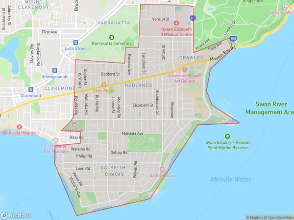
6009, 6907, and 6909 (In total, there are 3 postcodes in Nedlands Dalkeith Crawley.)Nedlands Dalkeith Crawley Suburb Area Map (Polygon)
Nedlands Dalkeith Crawley Introduction
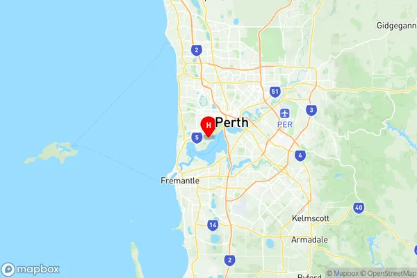
Nedlands Dalkeith Crawley is a suburb located in the City of Nedlands, which is a part of the Western Australian capital of Perth. It is situated approximately 8 kilometers from Perth's central business district (CBD) and is bordered by other suburbs such as Claremont, Wembley, and Subiaco. The suburb is named after the historic Nedlands mansion, which was built in the late 19th century and is now a heritage-listed site. Nedlands Dalkeith Crawley is a well-established suburb with a mix of residential and commercial properties. It has a variety of shops, cafes, restaurants, and medical facilities, as well as several parks and recreational areas. The suburb is also home to the University of Western Australia (UWA) and the Crawley campus, which is the main campus of the university's Faculty of Health and Medical Sciences. The suburb is well-connected to the rest of Perth via public transport, with several bus routes and the West Coast Railway Line passing through it. The Perth Airport is also located within easy reach, making it convenient for travelers. In summary, Nedlands Dalkeith Crawley is a vibrant and well-established suburb with a mix of residential and commercial properties, excellent transport links, and a range of amenities. It is a popular location for families, students, and professionals alike.Australia State
City or Big Region
Greater Capital City
Greater Perth (5GPER)District or Regional Area
Suburb Name
Nedlands Dalkeith Crawley Region Map
Nedlands Dalkeith Crawley Postcodes / Zip Codes
Nedlands Dalkeith Crawley Suburbs
Nedlands Dalkeith Crawley full address
Nedlands Dalkeith Crawley, Cottesloe Claremont, Perth Inner, Western Australia, WA, Australia, SaCode: 503011035Country
Nedlands Dalkeith Crawley, Cottesloe Claremont, Perth Inner, Western Australia, WA, Australia, SaCode: 503011035
Nedlands Dalkeith Crawley Suburbs & Region, Nedlands Dalkeith Crawley Map & Postcodes has 0 areas or regions above, and there are 7 Nedlands Dalkeith Crawley suburbs below. The sa2code for the Nedlands Dalkeith Crawley region is 503011035. Its latitude and longitude coordinates are -31.9837,115.815. Nedlands Dalkeith Crawley area belongs to Australia's greater capital city Greater Perth.
Nedlands Dalkeith Crawley Suburbs & Localities
1. Broadway Nedlands
2. Crawley
3. Dalkeith
4. Nedlands
5. Nedlands Dc
6. Nedlands
7. Nedlands