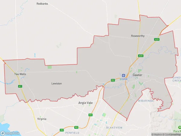
Gawler Two Wells Suburbs & Region, Gawler Two Wells Map & Postcodes
Gawler Two Wells Suburbs & Region, Gawler Two Wells Map & Postcodes in Gawler Two Wells, Adelaide North, SA, AU
Gawler Two Wells Region
Region Name
Gawler Two Wells (SA, AU)Gawler Two Wells Area
306.87 square kilometers (306.87 ㎢)Gawler Two Wells Introduction
Gawler Two Wells is a locality in the City of Charles Sturt, South Australia. It is located about 125 km north of Adelaide, the state capital. The area was originally inhabited by the Peramangk people, who had a strong connection to the land and its resources. The name 'Gawler Two Wells' comes from the two wells that were dug in the area in the late 1800s. These wells were important sources of water for the local community and were used for irrigation and drinking. Today, Gawler Two Wells is a thriving agricultural community with a population of around 1,000 people. The area is known for its rich soil and excellent grazing conditions, making it a popular location for farming and livestock production. The community has a number of facilities, including a primary school, a post office, a supermarket, and a community hall. There are also a number of recreational facilities in the area, including a golf course and a swimming pool.Australia State
City or Big Region
Greater Capital City
Greater Adelaide (4GADE)District or Regional Area
Gawler Two Wells Suburbs
Gawler Two Wells full address
Gawler Two Wells, Adelaide North, South Australia, SA, Australia, SaCode: 40201Country
Gawler Two Wells, Adelaide North, South Australia, SA, Australia, SaCode: 40201
Gawler Two Wells Suburbs & Region, Gawler Two Wells Map & Postcodes has 0 areas or regions above, and there are 0 Gawler Two Wells suburbs below. The sa3code for the Gawler Two Wells region is 40201. Gawler Two Wells area belongs to Australia's greater capital city Greater Adelaide.
