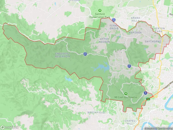
The Gap Enoggera Suburbs & Region, The Gap Enoggera Map & Postcodes
The Gap Enoggera Suburbs & Region, The Gap Enoggera Map & Postcodes in The Gap Enoggera, Brisbane West, QLD, AU
The Gap Enoggera Region
Region Name
The Gap Enoggera (QLD, AU)The Gap Enoggera Area
96.77 square kilometers (96.77 ㎢)The Gap Enoggera Introduction
The Gap Enoggera is a mountain in the Brisbane River Valley, located in the Mount Superbus Range of the Great Dividing Range in Queensland, Australia. It is part of the Gap Conservation Park. The mountain is named after the Enoggera Creek, which flows through the park. The Gap Enoggera is a popular hiking and picnic spot, with several walking trails and picnic areas. The mountain is also home to a variety of wildlife, including kangaroos, wallabies, and birds. The Gap Enoggera is a significant geological feature, with a number of caves and rock formations. The mountain is also a popular filming location, with several movies and TV shows having been shot in the area.Australia State
City or Big Region
Greater Capital City
Greater Brisbane (3GBRI)District or Regional Area
The Gap Enoggera Suburbs
The Gap Enoggera full address
The Gap Enoggera, Brisbane West, Queensland, QLD, Australia, SaCode: 30404Country
The Gap Enoggera, Brisbane West, Queensland, QLD, Australia, SaCode: 30404
The Gap Enoggera Suburbs & Region, The Gap Enoggera Map & Postcodes has 0 areas or regions above, and there are 0 The Gap Enoggera suburbs below. The sa3code for the The Gap Enoggera region is 30404. The Gap Enoggera area belongs to Australia's greater capital city Greater Brisbane.
