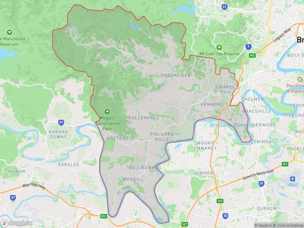
Kenmore Brookfield Moggill Suburbs & Region, Kenmore Brookfield Moggill Map & Postcodes
Kenmore Brookfield Moggill Suburbs & Region, Kenmore Brookfield Moggill Map & Postcodes in Kenmore Brookfield Moggill, Brisbane West, QLD, AU
Kenmore Brookfield Moggill Region
Region Name
Kenmore Brookfield Moggill (QLD, AU)Kenmore Brookfield Moggill Area
134.61 square kilometers (134.61 ㎢)Kenmore Brookfield Moggill Introduction
Kenmore Brookfield Moggill is a suburb in the City of Brisbane, Queensland, Australia. It is located 8 kilometers west of the Brisbane CBD and is part of the Brisbane West Region. The suburb is named after the Kenmore Brook, which flows through it. It is a popular residential area with a mix of houses, apartments, and townhouses. The suburb has a variety of amenities, including a shopping center, a medical center, and several parks. It is also home to the Kenmore State High School and the University of Queensland's Brisbane campus.Australia State
City or Big Region
Greater Capital City
Greater Brisbane (3GBRI)District or Regional Area
Kenmore Brookfield Moggill Suburbs
Kenmore Brookfield Moggill full address
Kenmore Brookfield Moggill, Brisbane West, Queensland, QLD, Australia, SaCode: 30402Country
Kenmore Brookfield Moggill, Brisbane West, Queensland, QLD, Australia, SaCode: 30402
Kenmore Brookfield Moggill Suburbs & Region, Kenmore Brookfield Moggill Map & Postcodes has 0 areas or regions above, and there are 0 Kenmore Brookfield Moggill suburbs below. The sa3code for the Kenmore Brookfield Moggill region is 30402. Kenmore Brookfield Moggill area belongs to Australia's greater capital city Greater Brisbane.
