Rowville Central Suburbs & Region, Rowville Central Map & Postcodes
Rowville Central Suburbs & Region, Rowville Central Map & Postcodes in Rowville Central, Knox, Melbourne Outer East, VIC, AU
Rowville Central Region
Region Name
Rowville Central (VIC, AU)Rowville Central Area
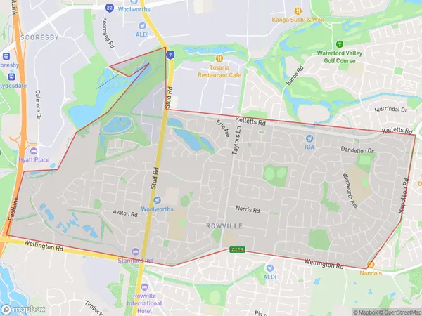
8.2 square kilometers (8.2 ㎢)Rowville Central Suburb Area Map (Polygon)
Australia State
City or Big Region
Greater Capital City
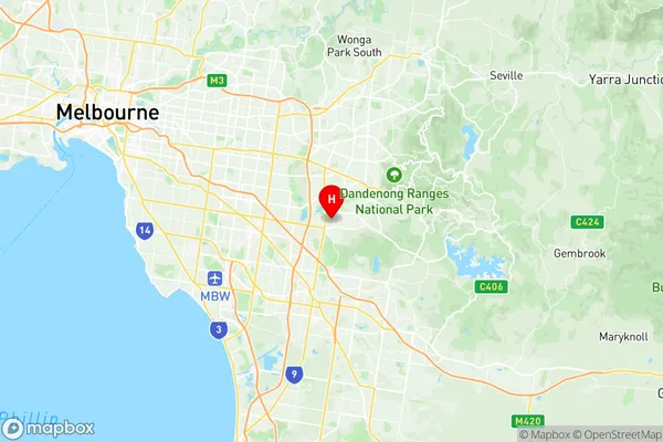
Greater Melbourne (2GMEL)District or Regional Area
Suburb Name
Rowville Central Region Map
Rowville Central Suburbs
Rowville Central full address
Rowville Central, Knox, Melbourne Outer East, Victoria, VIC, Australia, SaCode: 211011256Country
Rowville Central, Knox, Melbourne Outer East, Victoria, VIC, Australia, SaCode: 211011256
Rowville Central Suburbs & Region, Rowville Central Map & Postcodes has 0 areas or regions above, and there are 0 Rowville Central suburbs below. The sa2code for the Rowville Central region is 211011256. Its latitude and longitude coordinates are -37.921,145.242. Rowville Central area belongs to Australia's greater capital city Greater Melbourne.