Denistone Suburbs & Region, Denistone Map & Postcodes
Denistone Suburbs & Region, Denistone Map & Postcodes in Denistone, Ryde Hunters Hill, Sydney Ryde, NSW, AU
Denistone Region
Region Name
Denistone (NSW, AU)Denistone Area
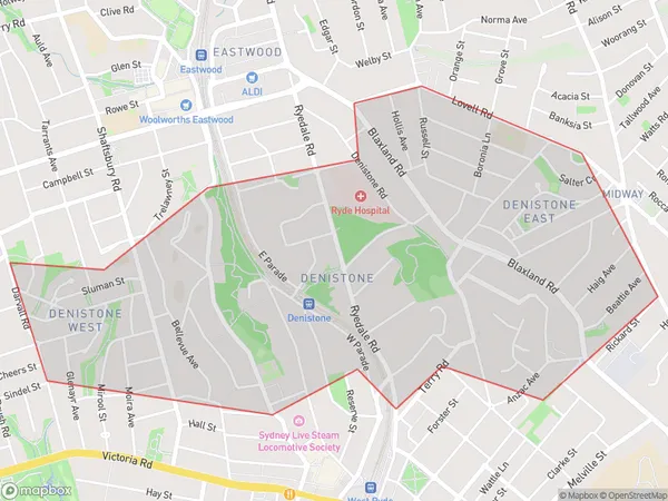
2.53 square kilometers (2.53 ㎢)Denistone Suburb Area Map (Polygon)
Denistone Introduction
Denistone is a suburb in the northern suburbs of Sydney, in the state of New South Wales, Australia. It is located 21 kilometers north-west of the Sydney central business district and is part of the Macarthur region. Denistone is named after the Denistone Estate, which was once the home of the wealthy Macarthur family. The suburb is characterized by its large houses, leafy streets, and excellent public transport links. It is home to a number of parks, including the Denistone Parklands, which features a golf course, picnic areas, and walking trails. Denistone also has a shopping center, a medical center, and a variety of restaurants and cafes. The suburb is well-connected to other parts of Sydney, with the M2 motorway and the North Shore railway line providing easy access to the city.Australia State
City or Big Region
Greater Capital City
Greater Sydney (1GSYD)District or Regional Area
Suburb Name
Denistone Suburbs
Denistone full address
Denistone, Ryde Hunters Hill, Sydney Ryde, New South Wales, NSW, Australia, SaCode: 126021722Country
Denistone, Ryde Hunters Hill, Sydney Ryde, New South Wales, NSW, Australia, SaCode: 126021722
Denistone Suburbs & Region, Denistone Map & Postcodes has 0 areas or regions above, and there are 0 Denistone suburbs below. The sa2code for the Denistone region is 126021722. Denistone area belongs to Australia's greater capital city Greater Sydney.