Erskine Park Suburbs & Region, Erskine Park Map & Postcodes
Erskine Park Suburbs & Region, Erskine Park Map & Postcodes in Erskine Park, St Marys, Sydney Outer West and Blue Mountains, NSW, AU
Erskine Park Region
Region Name
Erskine Park (NSW, AU)Erskine Park Area
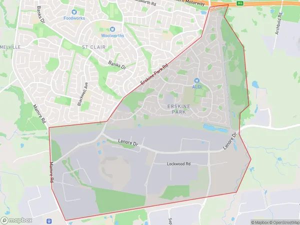
8.39 square kilometers (8.39 ㎢)Postal Codes
2759 (In total, there are 1 postcodes in Erskine Park.)Erskine Park Suburb Area Map (Polygon)
Erskine Park Introduction
Erskine Park is a suburb in the local government area of the City of Canada Bay, located in Sydney's outer west and Blue Mountains region, New South Wales, Australia. It is named after Sir John Erskine, a Scottish judge and politician. Erskine Park is located 36 kilometers west of Sydney's central business district and is part of the Greater Western Sydney region. The suburb has a population of around 11,000 people and is known for its scenic surroundings, including Erskine Park Reservoir and the Erskine Creek. The area is popular with outdoor enthusiasts, with many walking and cycling trails. Erskine Park also has a variety of shops, cafes, and restaurants, as well as a community center and a library.Australia State
City or Big Region
Greater Capital City
Greater Sydney (1GSYD)District or Regional Area
Suburb Name
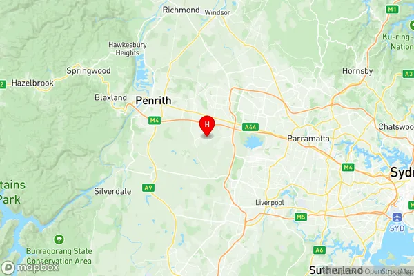
Erskine Park Region Map
Erskine Park Postcodes / Zip Codes
Erskine Park Suburbs
Erskine Park full address
Erskine Park, St Marys, Sydney Outer West and Blue Mountains, New South Wales, NSW, Australia, SaCode: 124051469Country
Erskine Park, St Marys, Sydney Outer West and Blue Mountains, New South Wales, NSW, Australia, SaCode: 124051469
Erskine Park Suburbs & Region, Erskine Park Map & Postcodes has 0 areas or regions above, and there are 1 Erskine Park suburbs below. The sa2code for the Erskine Park region is 124051469. Its latitude and longitude coordinates are -33.8132,150.801. Erskine Park area belongs to Australia's greater capital city Greater Sydney.
Erskine Park Suburbs & Localities
1. Erskine Park