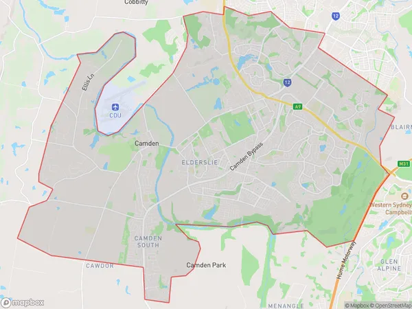
Camden Suburbs & Region, Camden Map & Postcodes
Camden Suburbs & Region, Camden Map & Postcodes in Camden, Sydney Outer South West, NSW, AU
Camden Region
Region Name
Camden (NSW, AU)Camden Area
73.87 square kilometers (73.87 ㎢)Camden Introduction
Camden is a suburb of Sydney, located in the state of New South Wales, Australia. It is situated in the Macarthur region and is approximately 50 kilometers southwest of the Sydney central business district. Camden is known for its historic architecture, including the Camden Park Inn and the Camden Showground. It is also home to a variety of industries, including manufacturing, agriculture, and tourism. The suburb has a population of around 50,000 people and is served by several public transport options, including buses and trains. Camden is also home to a number of parks and recreational facilities, including the Camden Lakeside Leisure Centre and the Camden Golf Club.Australia State
City or Big Region
Greater Capital City
Greater Sydney (1GSYD)District or Regional Area
Camden Suburbs
Elderslie Narellan
Camden full address
Camden, Sydney Outer South West, New South Wales, NSW, Australia, SaCode: 12301Country
Camden, Sydney Outer South West, New South Wales, NSW, Australia, SaCode: 12301
Camden Suburbs & Region, Camden Map & Postcodes has 5 areas or regions above, and there are 0 Camden suburbs below. The sa3code for the Camden region is 12301. Camden area belongs to Australia's greater capital city Greater Sydney.
