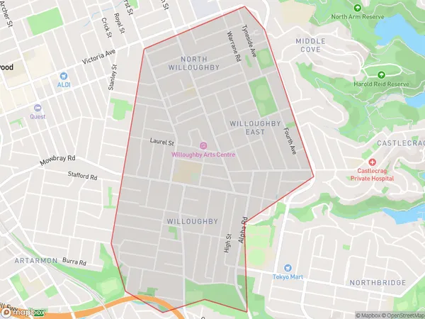
Willoughby Suburbs & Region, Willoughby Map & Postcodes
Willoughby Suburbs & Region, Willoughby Map & Postcodes in Willoughby, Chatswood Lane Cove, Sydney North Sydney and Hornsby, NSW, AU
Willoughby Region
Region Name
Willoughby (NSW, AU)Willoughby Area
3.07 square kilometers (3.07 ㎢)Willoughby Introduction
Willoughby, Sydney North Sydney and Hornsby is a suburb in northern Sydney, Australia. It is located 12 kilometers north of the Sydney central business district and is part of the North Shore region. The suburb is bordered by the Pacific Highway to the north, the Chatswood Chase shopping center to the east, and the Ku-ring-gai Chase National Park to the south. Willoughby is known for its leafy streets, historic homes, and vibrant community. It has a population of approximately 11,000 people and is home to a number of parks, schools, and recreational facilities. The suburb is also well-connected to public transport, with buses and trains servicing the area.Australia State
City or Big Region
Greater Capital City
Greater Sydney (1GSYD)District or Regional Area
Suburb Name
Willoughby Suburbs
Willoughby full address
Willoughby, Chatswood Lane Cove, Sydney North Sydney and Hornsby, New South Wales, NSW, Australia, SaCode: 121011687Country
Willoughby, Chatswood Lane Cove, Sydney North Sydney and Hornsby, New South Wales, NSW, Australia, SaCode: 121011687
Willoughby Suburbs & Region, Willoughby Map & Postcodes has 0 areas or regions above, and there are 0 Willoughby suburbs below. The sa2code for the Willoughby region is 121011687. Willoughby area belongs to Australia's greater capital city Greater Sydney.
