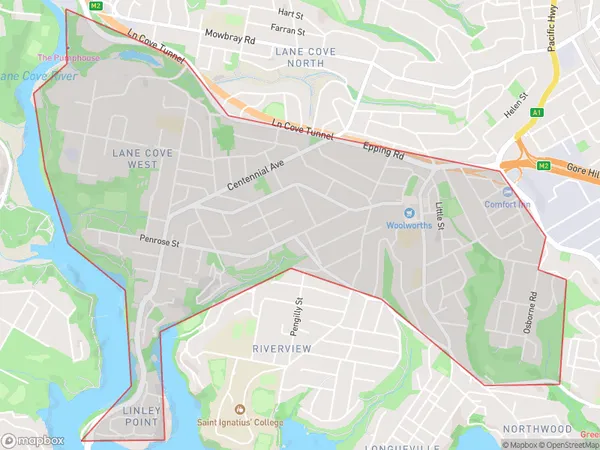
Lane Cove Suburbs & Region, Lane Cove Map & Postcodes
Lane Cove Suburbs & Region, Lane Cove Map & Postcodes in Lane Cove, Chatswood Lane Cove, Sydney North Sydney and Hornsby, NSW, AU
Lane Cove Region
Region Name
Lane Cove (NSW, AU)Lane Cove Area
4.47 square kilometers (4.47 ㎢)Lane Cove Introduction
Lane Cove is a suburb in Sydney, located in the state of New South Wales, Australia. It is situated in the northern suburbs of Sydney and is part of the North Sydney Council. Lane Cove is known for its peaceful atmosphere, leafy streets, and picturesque parks. It is home to a large population of professionals and families and is within easy reach of the city center. The suburb has a variety of shopping centers, restaurants, and cafes, as well as a community center and library. Lane Cove National Park is a popular recreational spot, offering stunning bushwalks and picnic areas. The area is also well-connected to public transportation, with buses and trains providing easy access to the city.Australia State
City or Big Region
Greater Capital City
Greater Sydney (1GSYD)District or Regional Area
Suburb Name
Lane Cove Suburbs
Lane Cove full address
Lane Cove, Chatswood Lane Cove, Sydney North Sydney and Hornsby, New South Wales, NSW, Australia, SaCode: 121011686Country
Lane Cove, Chatswood Lane Cove, Sydney North Sydney and Hornsby, New South Wales, NSW, Australia, SaCode: 121011686
Lane Cove Suburbs & Region, Lane Cove Map & Postcodes has 0 areas or regions above, and there are 0 Lane Cove suburbs below. The sa2code for the Lane Cove region is 121011686. Lane Cove area belongs to Australia's greater capital city Greater Sydney.
