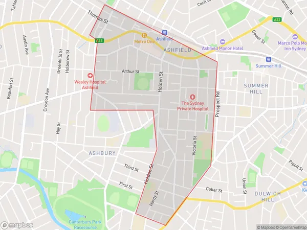
Ashfield South Suburbs & Region, Ashfield South Map & Postcodes
Ashfield South Suburbs & Region, Ashfield South Map & Postcodes in Ashfield South, Strathfield Burwood Ashfield, Sydney Inner West, NSW, AU
Ashfield South Region
Region Name
Ashfield South (NSW, AU)Ashfield South Area
2.11 square kilometers (2.11 ㎢)Ashfield South Introduction
Ashfield South is a suburb located in the Inner West of Sydney, New South Wales, Australia. It is situated 6 kilometers south of the Sydney central business district and is part of the City of Canada Bay. The suburb is known for its vibrant cultural scene and diverse population. It is home to a number of historic buildings, including the Ashfield Town Hall and the Ashfield Public Library. Ashfield South is also home to a number of parks and recreational facilities, including Ashfield Park, Bicentennial Park, and Harold Park. The area is well-connected to public transportation, with several bus routes and the Sydney Metro station located within walking distance.Australia State
City or Big Region
Greater Capital City
Greater Sydney (1GSYD)District or Regional Area
Suburb Name
Ashfield South Suburbs
Ashfield South full address
Ashfield South, Strathfield Burwood Ashfield, Sydney Inner West, New South Wales, NSW, Australia, SaCode: 120031677Country
Ashfield South, Strathfield Burwood Ashfield, Sydney Inner West, New South Wales, NSW, Australia, SaCode: 120031677
Ashfield South Suburbs & Region, Ashfield South Map & Postcodes has 0 areas or regions above, and there are 0 Ashfield South suburbs below. The sa2code for the Ashfield South region is 120031677. Ashfield South area belongs to Australia's greater capital city Greater Sydney.
