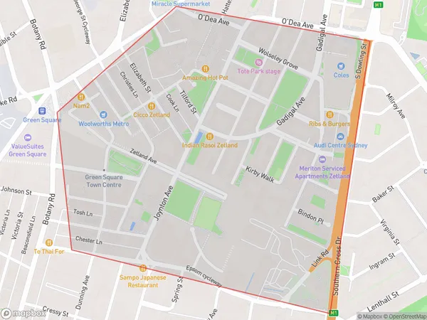
Zetland Suburbs & Region, Zetland Map & Postcodes
Zetland Suburbs & Region, Zetland Map & Postcodes in Zetland, Sydney Inner City, Sydney City and Inner South, NSW, AU
Zetland Region
Region Name
Zetland (NSW, AU)Zetland Area
0.8 square kilometers (0.8 ㎢)Zetland Introduction
Zetland is a suburb in Sydney, New South Wales, Australia. It is located 3 kilometers southeast of the Sydney central business district and is part of the City of Sydney local government area. Zetland is known for its vibrant atmosphere, with a mix of modern apartments and historic buildings. It is home to a large population of young professionals and students, and is popular for its nightlife and dining options. The suburb is also well-connected to other parts of Sydney, with several bus and train lines nearby.Australia State
City or Big Region
Greater Capital City
Greater Sydney (1GSYD)District or Regional Area
Suburb Name
Zetland Suburbs
Zetland full address
Zetland, Sydney Inner City, Sydney City and Inner South, New South Wales, NSW, Australia, SaCode: 117031648Country
Zetland, Sydney Inner City, Sydney City and Inner South, New South Wales, NSW, Australia, SaCode: 117031648
Zetland Suburbs & Region, Zetland Map & Postcodes has 0 areas or regions above, and there are 0 Zetland suburbs below. The sa2code for the Zetland region is 117031648. Zetland area belongs to Australia's greater capital city Greater Sydney.
