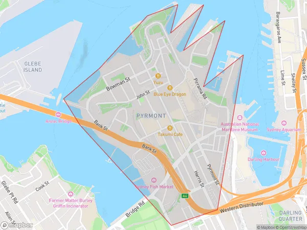
Pyrmont Suburbs & Region, Pyrmont Map & Postcodes
Pyrmont Suburbs & Region, Pyrmont Map & Postcodes in Pyrmont, Sydney Inner City, Sydney City and Inner South, NSW, AU
Pyrmont Region
Region Name
Pyrmont (NSW, AU)Pyrmont Area
0.93 square kilometers (0.93 ㎢)Pyrmont Introduction
Pyrmont is a suburb in Sydney, New South Wales, Australia. It is located 5 kilometers west of the Sydney central business district on the banks of the Darling Harbour. Pyrmont is known for its vibrant nightlife, with many restaurants, cafes, and bars in the area. It is also home to the Star Casino, which is one of Australia's largest casinos. The suburb is well-connected to other parts of Sydney, with public transport options including buses and trains. Pyrmont is a popular residential area, with many apartments and townhouses. It is also home to several parks and recreational facilities, including Pyrmont Bay Park and Birkenhead Point Reserve.Australia State
City or Big Region
Greater Capital City
Greater Sydney (1GSYD)District or Regional Area
Suburb Name
Pyrmont Suburbs
Pyrmont full address
Pyrmont, Sydney Inner City, Sydney City and Inner South, New South Wales, NSW, Australia, SaCode: 117031641Country
Pyrmont, Sydney Inner City, Sydney City and Inner South, New South Wales, NSW, Australia, SaCode: 117031641
Pyrmont Suburbs & Region, Pyrmont Map & Postcodes has 0 areas or regions above, and there are 0 Pyrmont suburbs below. The sa2code for the Pyrmont region is 117031641. Pyrmont area belongs to Australia's greater capital city Greater Sydney.
