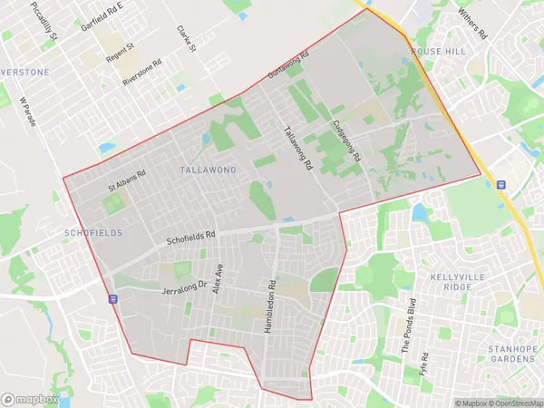
Schofields East Suburbs & Region, Schofields East Map & Postcodes
Schofields East Suburbs & Region, Schofields East Map & Postcodes in Schofields East, Blacktown North, Sydney Blacktown, NSW, AU
Schofields East Region
Region Name
Schofields East (NSW, AU)Schofields East Area
11.66 square kilometers (11.66 ㎢)Schofields East Introduction
Schofields East is a suburb in the City of Blacktown of New South Wales, Australia. It is located 26 kilometers west of Sydney's central business district and is part of the Greater Western Sydney region. The suburb is named after John Schofield, who was a landowner and politician in the area. Schofields East has a population of around 30,000 people and is known for its large industrial area and retail hub. The suburb also has a number of parks and recreational facilities, including the Schofields Showground and the John Palmer Reserve.Australia State
City or Big Region
Greater Capital City
Greater Sydney (1GSYD)District or Regional Area
Suburb Name
Schofields East Suburbs
Schofields East full address
Schofields East, Blacktown North, Sydney Blacktown, New South Wales, NSW, Australia, SaCode: 116021632Country
Schofields East, Blacktown North, Sydney Blacktown, New South Wales, NSW, Australia, SaCode: 116021632
Schofields East Suburbs & Region, Schofields East Map & Postcodes has 0 areas or regions above, and there are 0 Schofields East suburbs below. The sa2code for the Schofields East region is 116021632. Schofields East area belongs to Australia's greater capital city Greater Sydney.
