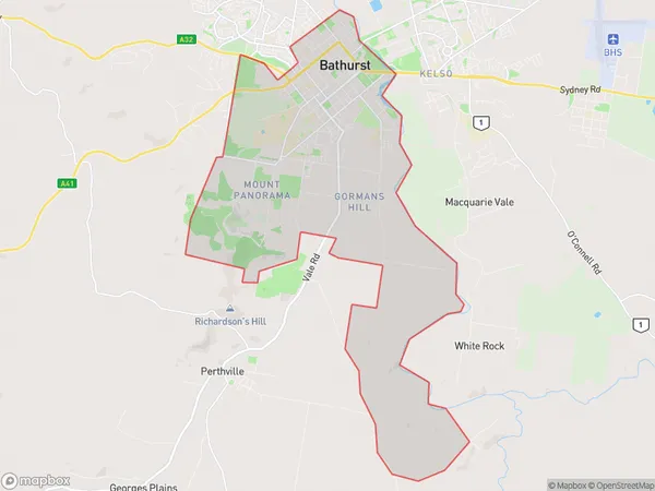
Bathurst South Suburbs & Region, Bathurst South Map & Postcodes
Bathurst South Suburbs & Region, Bathurst South Map & Postcodes in Bathurst South, Bathurst, Central West, NSW, AU
Bathurst South Region
Region Name
Bathurst South (NSW, AU)Bathurst South Area
37.48 square kilometers (37.48 ㎢)Bathurst South Introduction
Bathurst South is a locality in the Central West region of New South Wales, Australia. It is located in the Bathurst Regional Council and is situated approximately 316 kilometers west of the state capital, Sydney. The town is named after the Bathurst River, which flows through it. The population of Bathurst South at the 2016 census was 3,676. The town is known for its agricultural industry, with many farms located in the surrounding area. The town also has a historic railway station, which is on the Main Western line. The station was opened in 1882 and is a major stopping point for passengers traveling to and from Sydney.Australia State
City or Big Region
Greater Capital City
Rest of NSW (1RNSW)District or Regional Area
Suburb Name
Bathurst South Suburbs
Bathurst South full address
Bathurst South, Bathurst, Central West, New South Wales, NSW, Australia, SaCode: 103011612Country
Bathurst South, Bathurst, Central West, New South Wales, NSW, Australia, SaCode: 103011612
Bathurst South Suburbs & Region, Bathurst South Map & Postcodes has 0 areas or regions above, and there are 0 Bathurst South suburbs below. The sa2code for the Bathurst South region is 103011612. Bathurst South area belongs to Australia's greater capital city Rest of NSW.
