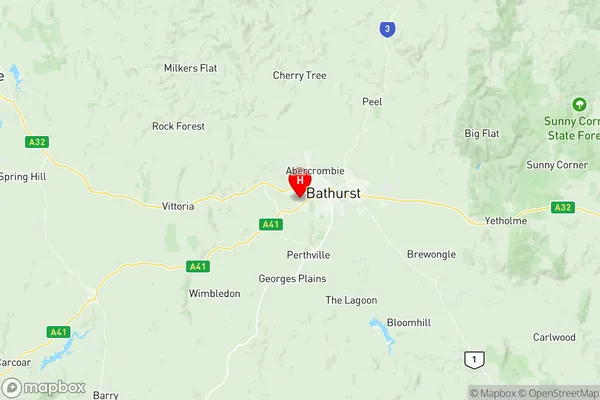
Bathurst Suburbs & Region, Bathurst Map & Postcodes
Bathurst Suburbs & Region, Bathurst Map & Postcodes in Bathurst, Orange, Central West, NSW, AU
Bathurst Region
Region Name
Bathurst (NSW, AU)Postal Codes
2795 (In total, there are 1 postcodes in Bathurst.)Bathurst Introduction
Bathurst is a city in the Central West region of New South Wales, Australia. It is located in the Bathurst District and is the seat of the Bathurst Regional Council. The city is known for its historic architecture, including the Bathurst Courthouse and the Church of England. It is also home to the Mount Panorama Circuit, which hosts the Bathurst 1000 motor race. The population of Bathurst is approximately 20,000 people.Australia State
City or Big Region
District or Regional Area
Suburb Name
Bathurst Region Map

Bathurst Postcodes / Zip Codes
Bathurst Suburbs
Bathurst full address
Bathurst, Orange, Central West, New South Wales, NSW, Australia, SaCode: 103011058Country
Bathurst, Orange, Central West, New South Wales, NSW, Australia, SaCode: 103011058
Bathurst Suburbs & Region, Bathurst Map & Postcodes has 0 areas or regions above, and there are 15 Bathurst suburbs below. The sa2code for the Bathurst region is 103011058. Its latitude and longitude coordinates are -33.4246,149.535.
Bathurst Suburbs & Localities
1. Abercrombie
2. Bathurst
3. Gormans Hill
4. Llanarth
5. Mount Panorama
6. Oconnell
7. West Bathurst
8. Stewarts Mount
9. Windradyne
10. Bathurst West
11. Eglinton
12. Charles Sturt University
13. Mitchell
14. South Bathurst
15. Robin Hill
