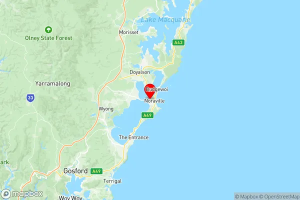
Toukley Norah Head Suburbs & Region, Toukley Norah Head Map & Postcodes
Toukley Norah Head Suburbs & Region, Toukley Norah Head Map & Postcodes in Toukley Norah Head, Wyong, Central Coast, NSW, AU
Toukley Norah Head Region
Region Name
Toukley Norah Head (NSW, AU)Toukley Norah Head Area
10.52 square kilometers (10.52 ㎢)Postal Codes
2263 (In total, there are 1 postcodes in Toukley Norah Head.)Toukley Norah Head Introduction
Toukley Norah Head is a suburb of the Central Coast region of New South Wales, Australia. It is located about 110 kilometers north of Sydney and 10 kilometers south of Gosford. The suburb is named after the Norah Head Lighthouse, which is located at the southern end of Norah Head Beach. The lighthouse was built in 1888 and is one of the oldest lighthouses in Australia. The suburb has a population of around 1,500 people and is known for its beautiful beaches, scenic walks, and tranquil environment. It is also home to a number of cafes, restaurants, and shops.Australia State
City or Big Region
Greater Capital City
Greater Sydney (1GSYD)District or Regional Area
Suburb Name
Toukley Norah Head Region Map

Toukley Norah Head Postcodes / Zip Codes
Toukley Norah Head Suburbs
Toukley Norah Head full address
Toukley Norah Head, Wyong, Central Coast, New South Wales, NSW, Australia, SaCode: 102021054Country
Toukley Norah Head, Wyong, Central Coast, New South Wales, NSW, Australia, SaCode: 102021054
Toukley Norah Head Suburbs & Region, Toukley Norah Head Map & Postcodes has 0 areas or regions above, and there are 4 Toukley Norah Head suburbs below. The sa2code for the Toukley Norah Head region is 102021054. Its latitude and longitude coordinates are -33.2625,151.546. Toukley Norah Head area belongs to Australia's greater capital city Greater Sydney.
Toukley Norah Head Suburbs & Localities
1. Canton Beach
2. Norah Head
3. Noraville
4. Toukley
