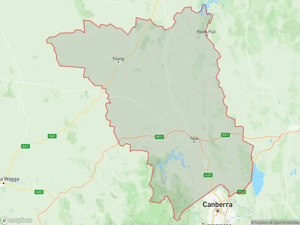
Young Yass Suburbs & Region, Young Yass Map & Postcodes
Young Yass Suburbs & Region, Young Yass Map & Postcodes in Young Yass, Capital Region, NSW, AU
Young Yass Region
Region Name
Young Yass (NSW, AU)Young Yass Area
12136 square kilometers (12,136 ㎢)Young Yass Introduction
Young is a town in the Central West region of New South Wales, Australia. It is located in the Macquarie Valley, 236 km west of Sydney, and 129 km south of Wagga Wagga. Young is situated on the banks of the Murrumbidgee River, and the town has a population of around 10,000 people. The town is known for its agricultural industry, with many farms and wineries in the surrounding area. Young also has a historic railway station, a museum, and a number of parks and recreational facilities. The town is surrounded by beautiful countryside, with the Blue Mountains to the west and the Werong Range to the east.Australia State
City or Big Region
Greater Capital City
Rest of NSW (1RNSW)District or Regional Area
Young Yass Suburbs
Young Yass full address
Young Yass, Capital Region, New South Wales, NSW, Australia, SaCode: 10106Country
Young Yass, Capital Region, New South Wales, NSW, Australia, SaCode: 10106
Young Yass Suburbs & Region, Young Yass Map & Postcodes has 0 areas or regions above, and there are 0 Young Yass suburbs below. The sa3code for the Young Yass region is 10106. Young Yass area belongs to Australia's greater capital city Rest of NSW.
