Margate Beach Area, Margate Beach Postcode(4019) & Map in Margate Beach, Moreton Bay - North, QLD
Margate Beach Area, Margate Beach Postcode(4019) & Map in Margate Beach, Moreton Bay - North, QLD, AU, Postcode: 4019
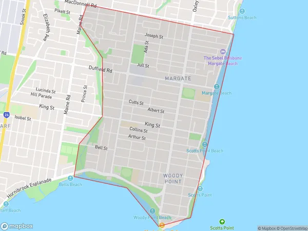
Margate Beach, Margate - Woody Point, Redcliffe, Moreton Bay - North, Queensland, Australia, 4019
Margate Beach Postcode
Area Name
Margate BeachMargate Beach Suburb Area Map (Polygon)
Margate Beach Introduction
Margate Beach is a suburban beach in the City of Redcliffe, Queensland, Australia. It is located on the southern side of Moreton Bay, approximately 20 kilometers north of Brisbane. The beach is known for its wide sandy shore, clear waters, and vibrant marine life. It is a popular destination for swimming, sunbathing, surfing, and fishing. There are also several parks and picnic areas nearby, as well as a shopping center and a variety of restaurants and cafes.State Name
City or Big Region
District or Regional Area
Suburb Name
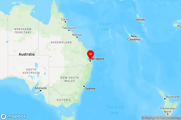
Margate Beach Region Map
Country
Main Region in AU
R2Coordinates
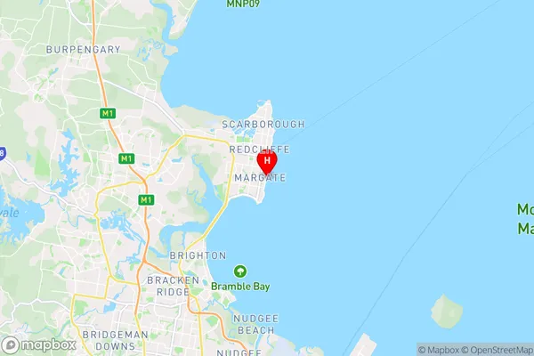
-27.24468,153.1116804 (latitude/longitude)Margate Beach Area Map (Street)
Longitude
153.088498Latitude
-27.248337Margate Beach Elevation
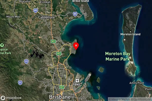
about 13.97 meters height above sea level (Altitude)Margate Beach Suburb Map (Satellite)
Distances
The distance from Margate Beach, Moreton Bay - North, QLD to AU Greater Capital CitiesSA1 Code 2011
31305137822SA1 Code 2016
31305137822SA2 Code
313051378SA3 Code
31305SA4 Code
313RA 2011
1RA 2016
1MMM 2015
1MMM 2019
1Charge Zone
Q1LGA Region
BrisbaneLGA Code
31000Electorate
Petrie