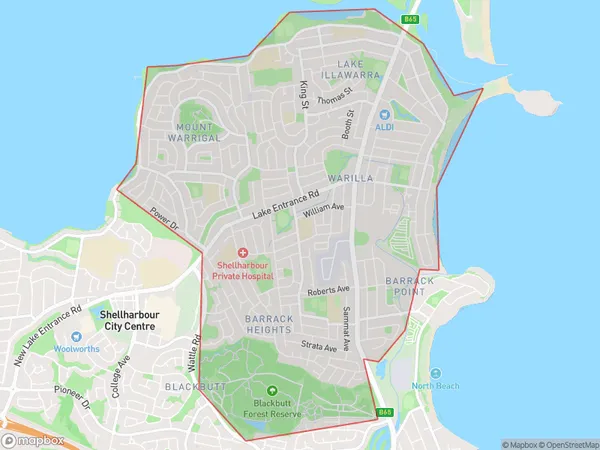
Barrack Heights Area, Barrack Heights Postcode(2528) & Map in Barrack Heights, Illawarra, NSW
Barrack Heights Area, Barrack Heights Postcode(2528) & Map in Barrack Heights, Illawarra, NSW, AU, Postcode: 2528
Barrack Heights, Warilla, Kiama - Shellharbour, Illawarra, New South Wales, Australia, 2528
Barrack Heights Postcode
Area Name
Barrack HeightsBarrack Heights Suburb Area Map (Polygon)
Barrack Heights Introduction
Barrack Heights is a suburb in the Illawarra region of New South Wales, Australia. It is located 68 kilometers south of Wollongong and 11 kilometers north of Kiama. The suburb is named after the former Barrack Heights railway station, which was located on the South Coast railway line. Barrack Heights is a popular residential area with a mix of detached houses and apartments. It has a large shopping center, a library, a community center, and several parks and recreational facilities. The suburb is also home to a number of significant industrial and commercial areas.State Name
City or Big Region
District or Regional Area
Suburb Name
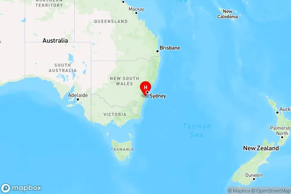
Barrack Heights Region Map
Country
Main Region in AU
R2Coordinates
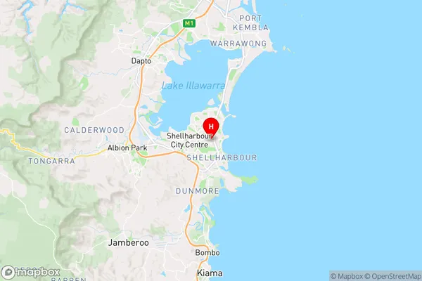
-34.565,150.856944 (latitude/longitude)Barrack Heights Area Map (Street)
Longitude
150.855135Latitude
-34.548722Barrack Heights Elevation
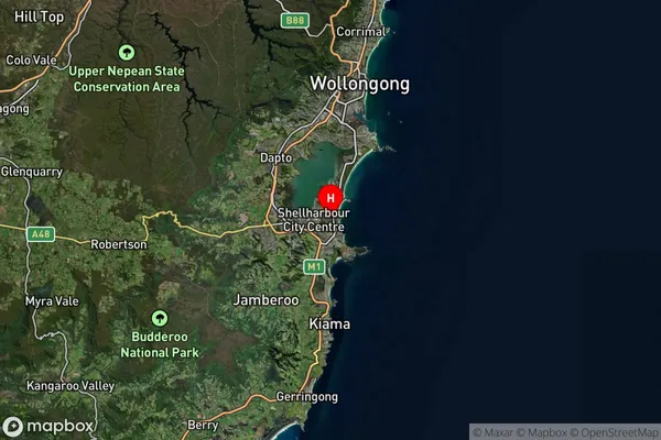
about 8.28 meters height above sea level (Altitude)Barrack Heights Suburb Map (Satellite)
Distances
The distance from Barrack Heights, Illawarra, NSW to AU Greater Capital CitiesSA1 Code 2011
10703114316SA1 Code 2016
10703114316SA2 Code
107031143SA3 Code
10703SA4 Code
107RA 2011
1RA 2016
1MMM 2015
1MMM 2019
1Charge Zone
N1LGA Region
ShellharbourLGA Code
16900Electorate
Whitlam