Reidtown Area, Reidtown Postcode(2519) & Map in Reidtown, Illawarra, NSW
Reidtown Area, Reidtown Postcode(2519) & Map in Reidtown, Illawarra, NSW, AU, Postcode: 2519
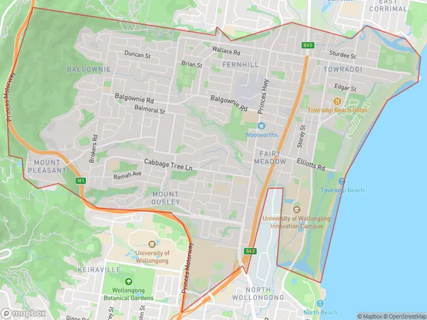
Reidtown, Balgownie - Fairy Meadow, Wollongong, Illawarra, New South Wales, Australia, 2519
Reidtown Postcode
Area Name
ReidtownReidtown Suburb Area Map (Polygon)
Reidtown Introduction
Reidtown is a suburb of Wollongong, located in the Illawarra region of New South Wales, Australia. It is situated 36 kilometers south of Wollongong's central business district and is part of the City of Wollongong. Reidtown is known for its historic railway station and the nearby Mount Keira Conservation Area, which offers scenic walks and views of the surrounding area.State Name
City or Big Region
District or Regional Area
Suburb Name
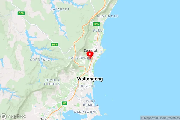
Reidtown Region Map

Country
Main Region in AU
R2Coordinates
-34.388885,150.893891 (latitude/longitude)Reidtown Area Map (Street)
Longitude
150.709623Latitude
-34.35558Reidtown Elevation
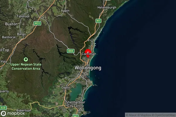
about 347.20 meters height above sea level (Altitude)Reidtown Suburb Map (Satellite)
Distances
The distance from Reidtown, Illawarra, NSW to AU Greater Capital CitiesSA1 Code 2011
10704114433SA1 Code 2016
10704114433SA2 Code
107041144SA3 Code
10704SA4 Code
107RA 2011
1RA 2016
1MMM 2015
1MMM 2019
1Charge Zone
N1LGA Region
WollongongLGA Code
18450Electorate
Cunningham