Collinswood Area, Collinswood Postcode(5081) & Map in Collinswood, Adelaide - Central and Hills, SA
Collinswood Area, Collinswood Postcode(5081) & Map in Collinswood, Adelaide - Central and Hills, SA, AU, Postcode: 5081
Collinswood, Nailsworth - Broadview, Prospect - Walkerville, Adelaide - Central and Hills, South Australia, Australia, 5081
Collinswood Postcode
Area Name
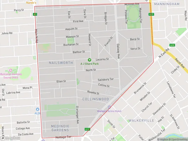
CollinswoodCollinswood Suburb Area Map (Polygon)
Collinswood Introduction
Collinswood is a suburb of Adelaide, South Australia, located in the City of Tea Tree Gully. It is known for its historic homes, tree-lined streets, and community spirit. The suburb has a variety of shops, restaurants, and parks, and is home to the Tea Tree Gully Football Club.State Name
City or Big Region
District or Regional Area
Suburb Name
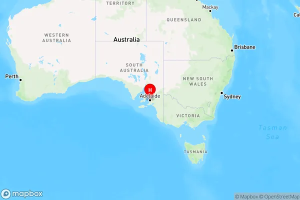
Collinswood Region Map
Country
Main Region in AU
R2Coordinates
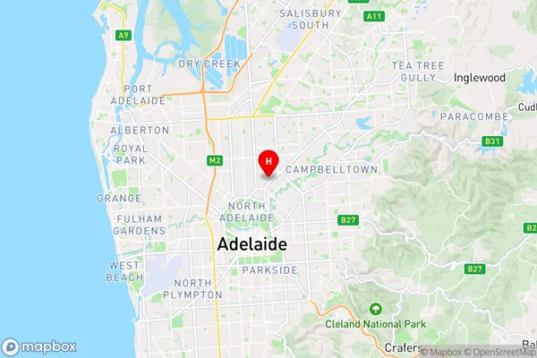
-34.8872207,138.6125795 (latitude/longitude)Collinswood Area Map (Street)
Longitude
138.617673Latitude
-34.891417Collinswood Elevation
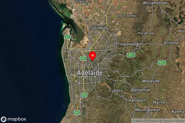
about 43.97 meters height above sea level (Altitude)Collinswood Suburb Map (Satellite)
Distances
The distance from Collinswood, Adelaide - Central and Hills, SA to AU Greater Capital CitiesSA1 Code 2011
40106102010SA1 Code 2016
40106102010SA2 Code
401061020SA3 Code
40106SA4 Code
401RA 2011
1RA 2016
1MMM 2015
1MMM 2019
1Charge Zone
S1LGA Region
WalkervilleLGA Code
48260Electorate
Adelaide