Waerenga Suburbs & Region, Waerenga Map & Postcodes in Waerenga, Waikato, Waikato
Waerenga Postcodes, Waerenga ZipCodes, Waerenga , Waerenga Waikato, Waerenga Suburbs, Waerenga Region, Waerenga Map, Waerenga Area
Waerenga Region (Okaeria, Taniwha Region)
Waerenga Suburbs
Waerenga is a suburb place type in Waikato, Waikato, NZ. It contains 0 suburbs or localities.Waerenga Postcodes
Waerenga district
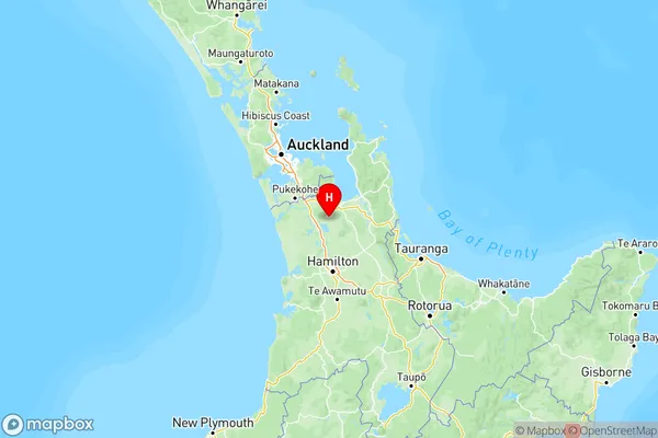
WaikatoWaerenga Region Map

Waerenga Introduction
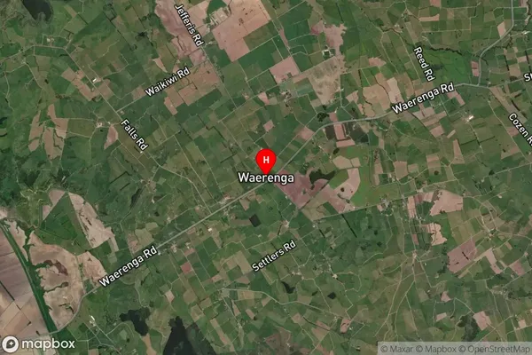
Waerenga is a small town in Waikato, New Zealand, located on State Highway 1. It is situated between the cities of Hamilton and Cambridge and is known for its beautiful rural surroundings and historic buildings. The town has a population of around 2,000 people and is home to a variety of businesses, including a supermarket, a pharmacy, and a hotel. Waerenga also has a popular golf course and a community hall, which hosts a variety of events throughout the year. The town is surrounded by farmland and has a peaceful and tranquil atmosphere.Waerenga Region
Waerenga City
Waerenga Satellite Map
Full Address
Waerenga, Waikato, WaikatoWaerenga Coordinates
-37.368145,175.243714 (Latitude / Longitude)Waerenga Map in NZ
NZ Island
North IslandCountry
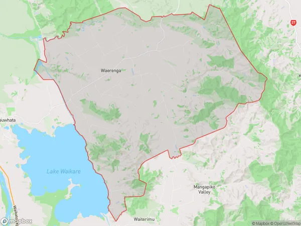
Waerenga Area Map (Polygon)
Name
WaerengaAdditional Name
Okaeria, TaniwhaLocal Authority
Waikato District
Waerenga Suburbs (Sort by Population)
Waerenga also known as Okaeria, Taniwha. Waerenga suburb has around
197.9 square
kilometers.There are more than 808 people (estimated)
live in Waerenga, Te Kauwhata, Waikato, New Zealand.