Peria Suburbs & Region, Peria Map & Postcodes in Peria, Far North, Northland
Peria Postcodes, Peria ZipCodes, Peria , Peria Northland, Peria Suburbs, Peria Region, Peria Map, Peria Area
Peria Region (Aputerewa, Fern Flat, Honeymoon Valley, Kaiaka, Oruru, Te Puhi Region)
Peria Suburbs
Peria is a suburb place type in Far North, Northland, NZ. It contains 0 suburbs or localities.Peria Postcodes
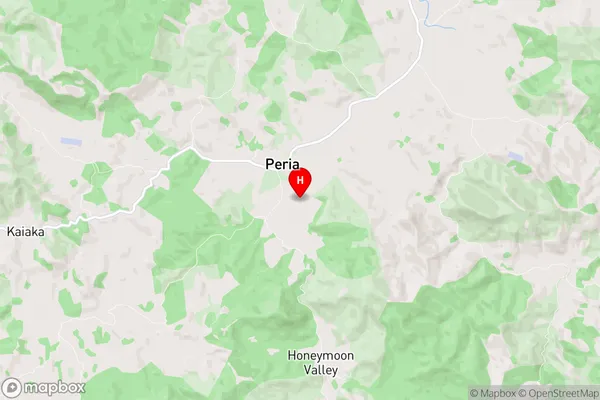
Peria district
Far NorthPeria Region Map
Peria Introduction
Peria is a small town in Northland, New Zealand, located on the banks of the Hokianga Harbour. It is known for its beautiful beaches, lush forests, and historic Maori settlements. The town has a population of around 1,000 people and is a popular destination for tourists and outdoor enthusiasts. The nearby Hokianga Harbour is a popular spot for fishing, kayaking, and sailing, and the town is also home to a number of scenic walks and hiking trails.Peria Region
Peria City
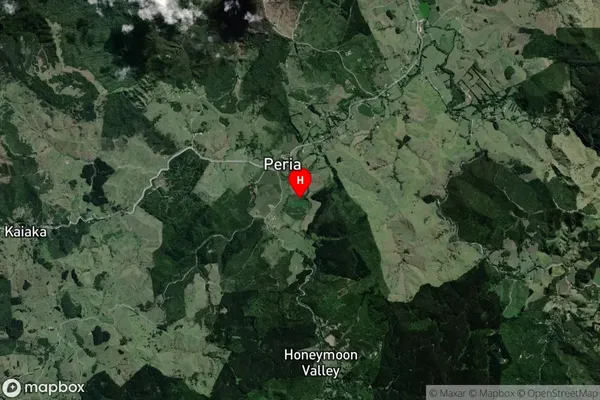
Peria Satellite Map
Full Address
Peria, Far North, NorthlandPeria Coordinates
-35.104659,173.489707 (Latitude / Longitude)Peria Map in NZ
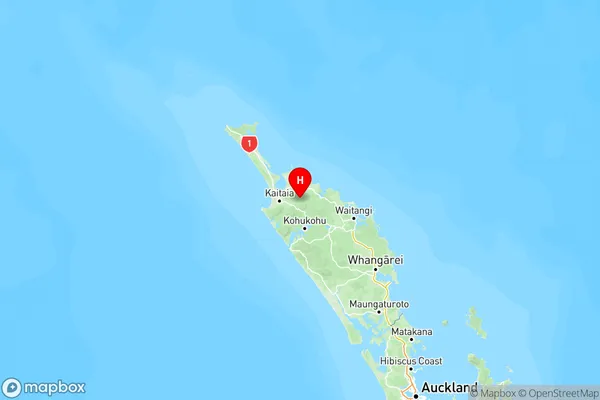
NZ Island
North IslandCountry
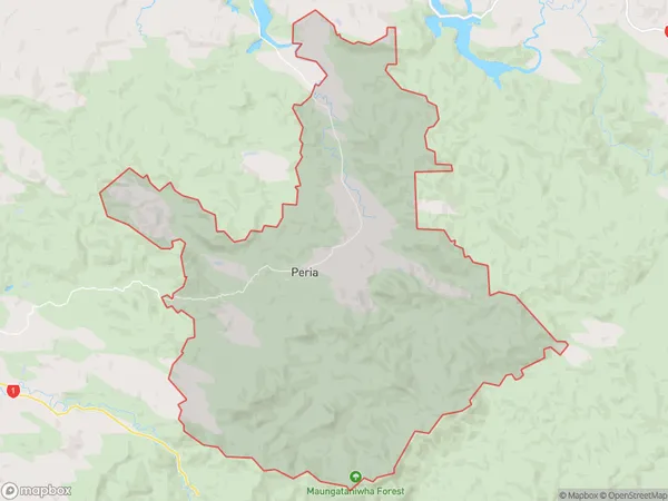
Peria Area Map (Polygon)
Name
PeriaAdditional Name
Aputerewa, Fern Flat, Honeymoon Valley, Kaiaka, Oruru, Te PuhiLocal Authority
Far North District
Peria Suburbs (Sort by Population)
Peria also known as Aputerewa, Fern Flat, Honeymoon Valley, Kaiaka, Oruru, Te Puhi. Peria suburb has around
176.1 square
kilometers.There are more than 868 people (estimated)
live in Peria, Te Hiku Community, Northland, New Zealand.