Te Rapa Suburbs & Region, Te Rapa Map & Postcodes in Te Rapa, Hamilton City, Waikato
Te Rapa Postcodes, Te Rapa ZipCodes, Te Rapa , Te Rapa Waikato, Te Rapa Suburbs, Te Rapa Region, Te Rapa Map, Te Rapa Area
Te Rapa Region (Avalon Industrial, Northgate Industrial, Pukete Industrial Region)
Te Rapa Suburbs
Te Rapa is a suburb place type in Hamilton City, Waikato, NZ. It contains 0 suburbs or localities.Te Rapa Region Map
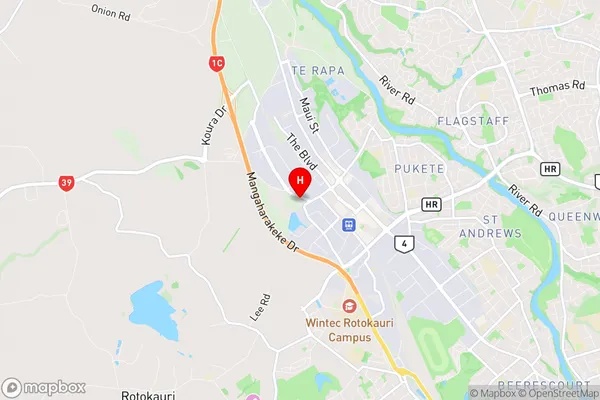
Te Rapa Introduction
Te Rapa is a small town located in the Waikato region of New Zealand. It is situated on the banks of the Waikato River, approximately 35 kilometers south of Hamilton. The town has a population of around 3,500 people and is known for its fertile farmland and historic buildings. Te Rapa is also home to a number of popular tourist attractions, including the Te Rapa Racecourse, the Waikato Museum, and the Waikato Riverwalk. The town was founded in 1865 and named after the nearby Te Rapa Island, which is a popular spot for fishing and swimming.Te Rapa Region
Te Rapa City
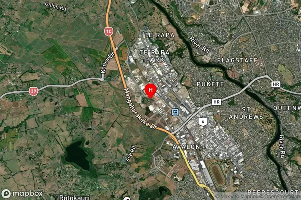
Te Rapa Satellite Map
Full Address
Te Rapa, Hamilton City, WaikatoTe Rapa Coordinates
-37.745946,175.222125 (Latitude / Longitude)Te Rapa Map in NZ
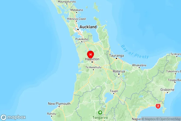
NZ Island
North IslandCountry
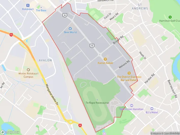
Te Rapa Area Map (Polygon)
Name
Te RapaAdditional Name
Avalon Industrial, Northgate Industrial, Pukete IndustrialLocal Authority
Hamilton City
Te Rapa Suburbs (Sort by Population)
Te Rapa also known as Avalon Industrial, Northgate Industrial, Pukete Industrial. Te Rapa suburb has around
2.7 square
kilometers.There are more than 470 people (estimated)
live in Te Rapa, Hamilton, Waikato, New Zealand.