Horohoro Suburbs & Region, Horohoro Map & Postcodes in Horohoro, Rotorua, Bay of Plenty
Horohoro Postcodes, Horohoro ZipCodes, Horohoro , Horohoro Bay of Plenty, Horohoro Suburbs, Horohoro Region, Horohoro Map, Horohoro Area
Horohoro Region (Guthrie, Waireka Region)
Horohoro Suburbs
Horohoro is a suburb place type in Rotorua, Bay of Plenty, NZ. It contains 0 suburbs or localities.Horohoro Region Map
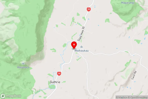
Horohoro Introduction
Horohoro is a small rural town in the Bay of Plenty region of New Zealand. It is located on the eastern coast of the North Island and is known for its beautiful beaches, lush forests, and warm climate. The town has a population of around 1,000 people and is surrounded by farmland and picturesque countryside. Horohoro is a popular destination for tourists and has a number of accommodation options, including a motel, a holiday park, and a campground. The town also has a small supermarket, a pharmacy, a post office, and a few cafes and restaurants. The nearby Horohoro Beach is a popular spot for swimming, surfing, and fishing, and the nearby Horohoro Forest Reserve is a great place for hiking and nature walks.Horohoro Region
Horohoro City
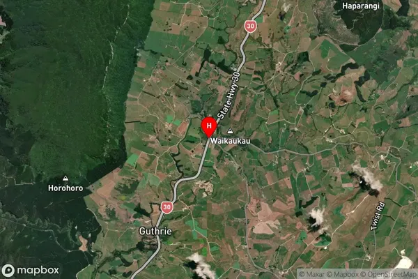
Horohoro Satellite Map
Full Address
Horohoro, Rotorua, Bay of PlentyHorohoro Coordinates
-38.2656402,176.1646173 (Latitude / Longitude)Horohoro Map in NZ
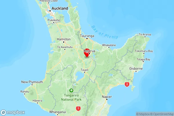
NZ Island
North IslandCountry
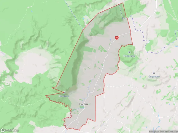
Horohoro Area Map (Polygon)
Name
HorohoroAdditional Name
Guthrie, WairekaLocal Authority
Rotorua District
Horohoro Suburbs (Sort by Population)
Horohoro also known as Guthrie, Waireka. Horohoro suburb has around
56.2 square
kilometers.There are more than 237 people (estimated)
live in Horohoro, Rotorua, Waikato, New Zealand.