Lochiel Suburbs & Region, Lochiel Map & Postcodes in Lochiel, Winton, Southland
Lochiel Postcodes, Lochiel ZipCodes, Lochiel , Lochiel Southland, Lochiel Suburbs, Lochiel Region, Lochiel Map, Lochiel Area
Lochiel Region (Wilsons Crossing Region)
Lochiel Suburbs
Lochiel is a suburb place type in Winton, Southland, NZ. It contains 0 suburbs or localities.Lochiel Postcodes
Lochiel district
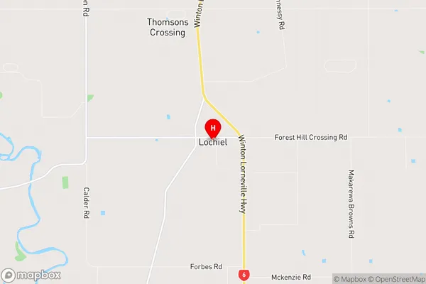
SouthlandLochiel Region Map
Lochiel Introduction
Lochiel is a small township in Southland, New Zealand, located on the southern shores of Lake Wakatipu. It is known for its scenic beauty, with the surrounding mountains and forests providing a tranquil setting. The township has a population of around 300 people and is home to a variety of businesses, including a hotel, a convenience store, and a petrol station. Lochiel is also a popular destination for outdoor activities, such as hiking, fishing, and skiing, with several nearby trails and lakes. The town is surrounded by stunning scenery, including the Southern Alps and the Mount Aspiring National Park.Lochiel Region
Lochiel City
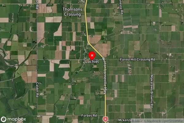
Lochiel Satellite Map
Full Address
Lochiel, Winton, SouthlandLochiel Coordinates
-46.20594,168.33366 (Latitude / Longitude)Lochiel Map in NZ
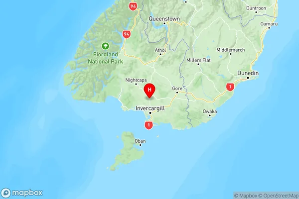
NZ Island
South IslandCountry
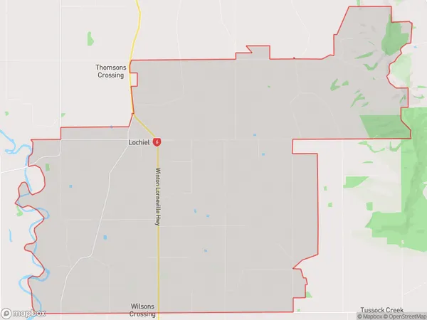
Lochiel Area Map (Polygon)
Name
LochielAdditional Name
Wilsons CrossingLocal Authority
Southland District
Lochiel Suburbs (Sort by Population)
Lochiel also known as Wilsons Crossing. Lochiel suburb has around
80.3 square
kilometers.There are more than 407 people (estimated)
live in Lochiel, Oreti Community, Southland, New Zealand.