Gimmerburn Suburbs & Region, Gimmerburn Map & Postcodes in Gimmerburn, Central Otago, Central Otago / Lakes District, Otago, South Island, New Zealand
Gimmerburn Postcodes, Gimmerburn ZipCodes, Gimmerburn , Gimmerburn Otago, Gimmerburn Suburbs, Gimmerburn Region, Gimmerburn Map, Gimmerburn Area
Gimmerburn Region
Gimmerburn Suburbs
Gimmerburn is a suburb place type in Central Otago, Central Otago / Lakes District, Otago, South Island, New Zealand, NZ. It contains 0 suburbs or localities.Gimmerburn Postcodes
Gimmerburn district
Central OtagoGimmerburn Region Map
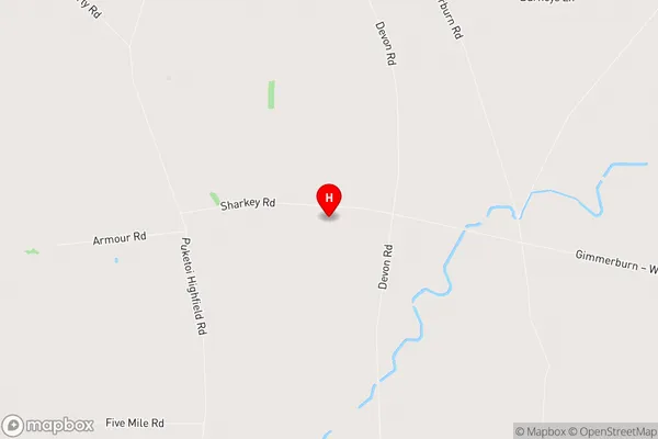
Gimmerburn Introduction
Gimmerburn is a small rural town located in the Otago region of New Zealand, approximately 30 kilometers south of Dunedin. It is known for its scenic surroundings, including the Gimmerburn Forest Park, which is a popular hiking and mountain biking destination. The town has a population of around 1,000 people and is surrounded by farmland and picturesque landscapes. Gimmerburn also has a primary school, a convenience store, and a community hall. The town is named after the Gimmerburn River, which flows through the area and provides water for irrigation and hydroelectric power.Gimmerburn Region
Gimmerburn City
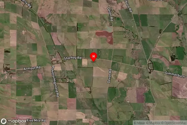
Gimmerburn Satellite Map
Full Address
Gimmerburn, Central Otago, Central Otago / Lakes District, Otago, South Island, New ZealandGimmerburn Coordinates
-45.16084,169.967131 (Latitude / Longitude)Gimmerburn Map in NZ
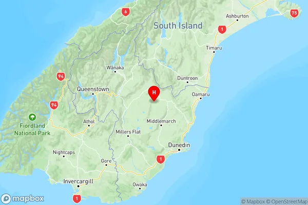
NZ Island
South IslandCountry
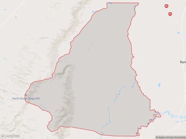
Gimmerburn Area Map (Polygon)
Name
GimmerburnAdditional Name
Local Authority
Central Otago District
Gimmerburn Suburbs (Sort by Population)
Gimmerburn suburb has around
220.6 square
kilometers.There are more than 50 people (estimated)
live in Gimmerburn, Central Otago / Lakes District, Otago, New Zealand.