Te Puninga Suburbs & Region, Te Puninga Map & Postcodes in Te Puninga, Morrinsville, Waikato
Te Puninga Postcodes, Te Puninga ZipCodes, Te Puninga , Te Puninga Waikato, Te Puninga Suburbs, Te Puninga Region, Te Puninga Map, Te Puninga Area
Te Puninga Region
Te Puninga Suburbs
Te Puninga is a suburb place type in Morrinsville, Waikato, NZ. It contains 0 suburbs or localities.Te Puninga Postcodes
Te Puninga district
Matamata-PiakoTe Puninga Region Map
Te Puninga Introduction
Waikato is a region in the central North Island of New Zealand. It is home to the city of Hamilton, which is the country's largest city. The region is known for its fertile farmland, scenic landscapes, and outdoor activities such as hiking, cycling, and fishing. Waikato also has a rich cultural heritage, with many historic sites and museums. The region is located around the Waikato River, which flows through the region from the Southern Alps to the Pacific Ocean.Te Puninga Region
Te Puninga City
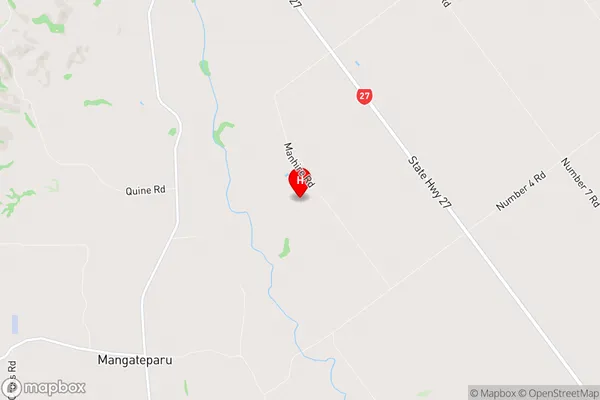
Te Puninga Satellite Map

Full Address
Te Puninga, Morrinsville, WaikatoTe Puninga Coordinates
-37.56815,175.528811 (Latitude / Longitude)Te Puninga Map in NZ
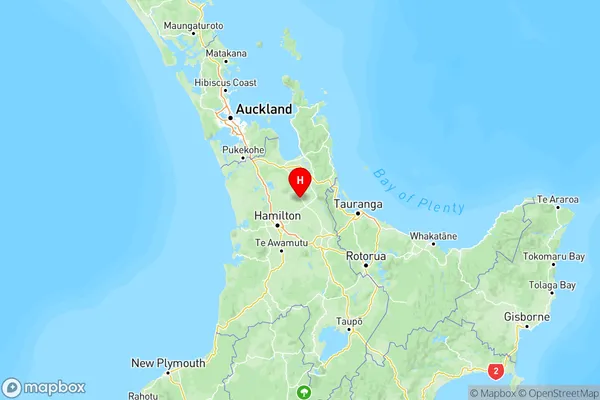
NZ Island
North IslandCountry
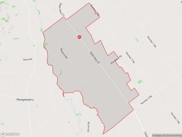
Te Puninga Area Map (Polygon)
Name
Te PuningaAdditional Name
Local Authority
Matamata-Piako District
Te Puninga Suburbs (Sort by Population)
Te Puninga suburb has around
29.3 square
kilometers.There are more than 204 people (estimated)
live in Te Puninga, Morrinsville, Waikato, New Zealand.