Saint Leonards Suburbs & Region, Saint Leonards Map & Postcodes in Saint Leonards, Dunedin City, Otago
Saint Leonards Postcodes, Saint Leonards ZipCodes, Saint Leonards , Saint Leonards Otago, Saint Leonards Suburbs, Saint Leonards Region, Saint Leonards Map, Saint Leonards Area
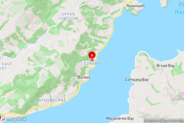
Saint Leonards Region (Burkes, St Leonards Region)
Saint Leonards Suburbs
Saint Leonards is a suburb place type in Dunedin City, Otago, NZ. It contains 0 suburbs or localities.Saint Leonards Postcodes
Saint Leonards Region Map
Saint Leonards Introduction
Saint Leonards is a suburb of Dunedin, New Zealand, located on the city's eastern coast. It is known for its beautiful beaches, historic buildings, and vibrant community. The suburb has a population of around 10,000 people and is home to a variety of shops, restaurants, and recreational facilities. Saint Leonards is also home to a large number of artists and musicians, and is known for its cultural diversity. The suburb is well-connected to the rest of Dunedin via public transport, and is only a short drive from the city center.Saint Leonards Region
Saint Leonards City
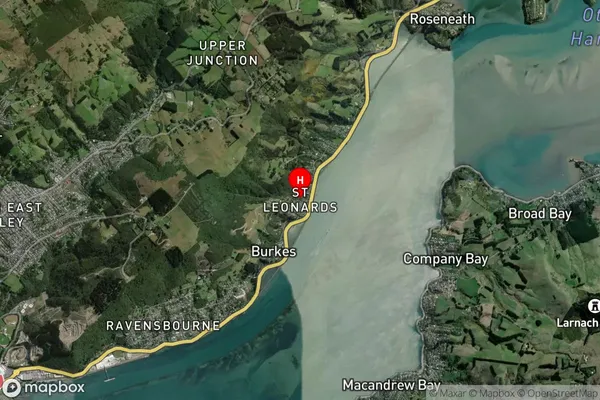
Saint Leonards Satellite Map
Full Address
Saint Leonards, Dunedin City, OtagoSaint Leonards Coordinates
-45.848967,170.576508 (Latitude / Longitude)Saint Leonards Map in NZ
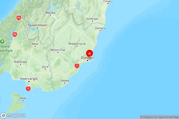
NZ Island
South IslandCountry
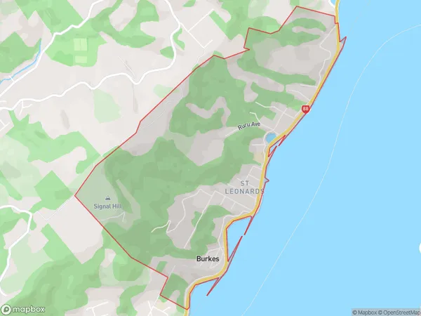
Saint Leonards Area Map (Polygon)
Name
Saint LeonardsAdditional Name
Burkes, St LeonardsLocal Authority
Dunedin City
Saint Leonards Suburbs (Sort by Population)
Saint Leonards also known as Burkes, St Leonards. Saint Leonards suburb has around
4.0 square
kilometers.There are more than 721 people (estimated)
live in Saint Leonards, Dunedin, Otago, New Zealand.