Southbridge Suburbs & Region, Southbridge Map & Postcodes in Southbridge, Selwyn, Canterbury
Southbridge Postcodes, Southbridge ZipCodes, Southbridge , Southbridge Canterbury, Southbridge Suburbs, Southbridge Region, Southbridge Map, Southbridge Area
Southbridge Region
Southbridge Suburbs
Southbridge is a suburb place type in Selwyn, Canterbury, NZ. It contains 0 suburbs or localities.Southbridge district
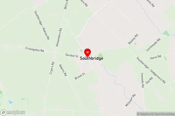
SelwynSouthbridge Region Map
Southbridge Introduction
Southbridge is a suburb of Christchurch, New Zealand. It is located in the eastern part of the city, bordering the Avon River. Southbridge is known for its historic buildings, including the Southbridge Hotel and the Southbridge Arcade. The suburb has a variety of shops, cafes, and restaurants, and is popular with tourists and locals alike. Southbridge also has a community center and a library.Southbridge Region
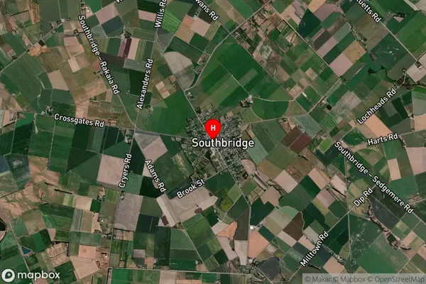
Southbridge Satellite Map
Full Address
Southbridge, Selwyn, CanterburySouthbridge Coordinates
-43.8117847,172.2520752 (Latitude / Longitude)Southbridge Map in NZ
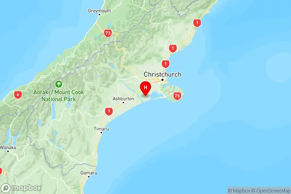
NZ Island
South IslandCountry